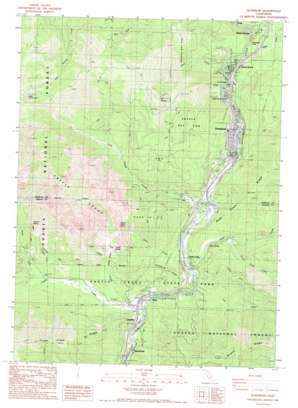
Dunsmuir Topo Map California
To zoom in, hover over the map of Dunsmuir
USGS Topo Quad 41122b3 - 1:24,000 scale
| Topo Map Name: | Dunsmuir |
| USGS Topo Quad ID: | 41122b3 |
| Print Size: | ca. 21 1/4" wide x 27" high |
| Southeast Coordinates: | 41.125° N latitude / 122.25° W longitude |
| Map Center Coordinates: | 41.1875° N latitude / 122.3125° W longitude |
| U.S. State: | CA |
| Filename: | o41122b3.jpg |
| Download Map JPG Image: | Dunsmuir topo map 1:24,000 scale |
| Map Type: | Topographic |
| Topo Series: | 7.5´ |
| Map Scale: | 1:24,000 |
| Source of Map Images: | United States Geological Survey (USGS) |
| Alternate Map Versions: |
Dunsmuir CA 1986, updated 1986 Download PDF Buy paper map Dunsmuir CA 1998, updated 2003 Download PDF Buy paper map Dunsmuir CA 2012 Download PDF Buy paper map Dunsmuir CA 2015 Download PDF Buy paper map |
| FStopo: | US Forest Service topo Dunsmuir is available: Download FStopo PDF Download FStopo TIF |
1:24,000 Topo Quads surrounding Dunsmuir
> Back to 41122a1 at 1:100,000 scale
> Back to 41122a1 at 1:250,000 scale
> Back to U.S. Topo Maps home
Dunsmuir topo map: Gazetteer
Dunsmuir: Cliffs
Castle Crags elevation 1750m 5741′Dunsmuir: Falls
Mossbrae Falls elevation 771m 2529′Dunsmuir: Forests
Shasta National Forest elevation 1073m 3520′Dunsmuir: Lakes
Little Castle Lake elevation 1699m 5574′Dunsmuir: Parks
Castle Crags State Park elevation 1215m 3986′Dunsmuir: Populated Places
Castella elevation 594m 1948′Castle Crag elevation 652m 2139′
Dirigo elevation 605m 1984′
Dunsmuir elevation 695m 2280′
Riverwood Mobile Home Estates elevation 666m 2185′
Shasta Retreat elevation 796m 2611′
Shasta Springs elevation 878m 2880′
Sweetbriar elevation 586m 1922′
Dunsmuir: Post Offices
Castle Crags Post Office (historical) elevation 652m 2139′Dunsmuir Post Office elevation 725m 2378′
Dunsmuir: Ridges
Flume Creek Ridge elevation 1431m 4694′Kettlebelly Ridge elevation 808m 2650′
Dunsmuir: Springs
Cave Springs elevation 733m 2404′Indian Springs elevation 1094m 3589′
Popcorn Spring elevation 995m 3264′
Soda Spring elevation 659m 2162′
Soda Springs elevation 606m 1988′
Upper Soda Springs elevation 718m 2355′
Dunsmuir: Streams
Bear Creek elevation 732m 2401′Castle Creek elevation 610m 2001′
Fall Creek elevation 625m 2050′
Hedge Creek elevation 752m 2467′
Indian Creek elevation 619m 2030′
Little Castle Creek elevation 659m 2162′
North Fork Castle Creek elevation 697m 2286′
Root Creek elevation 641m 2103′
Soda Creek elevation 628m 2060′
South Soda Creek elevation 669m 2194′
Sulphur Creek elevation 707m 2319′
Dunsmuir: Summits
Castle Dome elevation 1472m 4829′Mount Bradley elevation 1680m 5511′
Dunsmuir: Trails
Castle Lake Trail elevation 1711m 5613′Crags Trail elevation 1049m 3441′
Indian Creek Trail elevation 665m 2181′
River Trail elevation 609m 1998′
Root Creek Trail elevation 832m 2729′
Dunsmuir: Valleys
Winton Canyon elevation 785m 2575′Dunsmuir digital topo map on disk
Buy this Dunsmuir topo map showing relief, roads, GPS coordinates and other geographical features, as a high-resolution digital map file on DVD:


