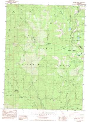
Mumbo Basin Topo Map California
To zoom in, hover over the map of Mumbo Basin
USGS Topo Quad 41122b5 - 1:24,000 scale
| Topo Map Name: | Mumbo Basin |
| USGS Topo Quad ID: | 41122b5 |
| Print Size: | ca. 21 1/4" wide x 27" high |
| Southeast Coordinates: | 41.125° N latitude / 122.5° W longitude |
| Map Center Coordinates: | 41.1875° N latitude / 122.5625° W longitude |
| U.S. State: | CA |
| Filename: | o41122b5.jpg |
| Download Map JPG Image: | Mumbo Basin topo map 1:24,000 scale |
| Map Type: | Topographic |
| Topo Series: | 7.5´ |
| Map Scale: | 1:24,000 |
| Source of Map Images: | United States Geological Survey (USGS) |
| Alternate Map Versions: |
Mumbo Basin CA 1986, updated 1986 Download PDF Buy paper map Mumbo Basin CA 1986, updated 1986 Download PDF Buy paper map Mumbo Basin CA 1998, updated 2003 Download PDF Buy paper map Mumbo Basin CA 2012 Download PDF Buy paper map Mumbo Basin CA 2015 Download PDF Buy paper map |
| FStopo: | US Forest Service topo Mumbo Basin is available: Download FStopo PDF Download FStopo TIF |
1:24,000 Topo Quads surrounding Mumbo Basin
> Back to 41122a1 at 1:100,000 scale
> Back to 41122a1 at 1:250,000 scale
> Back to U.S. Topo Maps home
Mumbo Basin topo map: Gazetteer
Mumbo Basin: Basins
Mumbo Basin elevation 1754m 5754′Mumbo Basin: Gaps
Salmon elevation 1807m 5928′Mumbo Basin: Lakes
Gumboot Lake elevation 1859m 6099′Mumbo Lake elevation 1861m 6105′
Picayune Lake elevation 1861m 6105′
Upper Gumboot Lake elevation 1900m 6233′
Upper Mumbo Lake elevation 1864m 6115′
Mumbo Basin: Mines
Altoona Mine elevation 1375m 4511′Integral Mine elevation 1444m 4737′
Mumbo Basin: Ridges
Blue Divide elevation 1996m 6548′Sherer Ridge elevation 1736m 5695′
The Bedstead elevation 1484m 4868′
Mumbo Basin: Streams
Baker Creek elevation 1267m 4156′Crow Creek elevation 1145m 3756′
West Branch Crow Creek elevation 1455m 4773′
Mumbo Basin: Summits
Ramshorn Summit elevation 1553m 5095′Mumbo Basin: Trails
Fred Williams Trail elevation 1731m 5679′Mumbo Basin: Valleys
Big Bear Gulch elevation 1494m 4901′Chrome Gulch elevation 1271m 4169′
Cinnabar Gulch elevation 1410m 4625′
Doe Gulch elevation 1167m 3828′
Little Bear Gulch elevation 1574m 5164′
Spike Buck Gulch elevation 1418m 4652′
Willits Ravine elevation 1369m 4491′
Mumbo Basin digital topo map on disk
Buy this Mumbo Basin topo map showing relief, roads, GPS coordinates and other geographical features, as a high-resolution digital map file on DVD:


