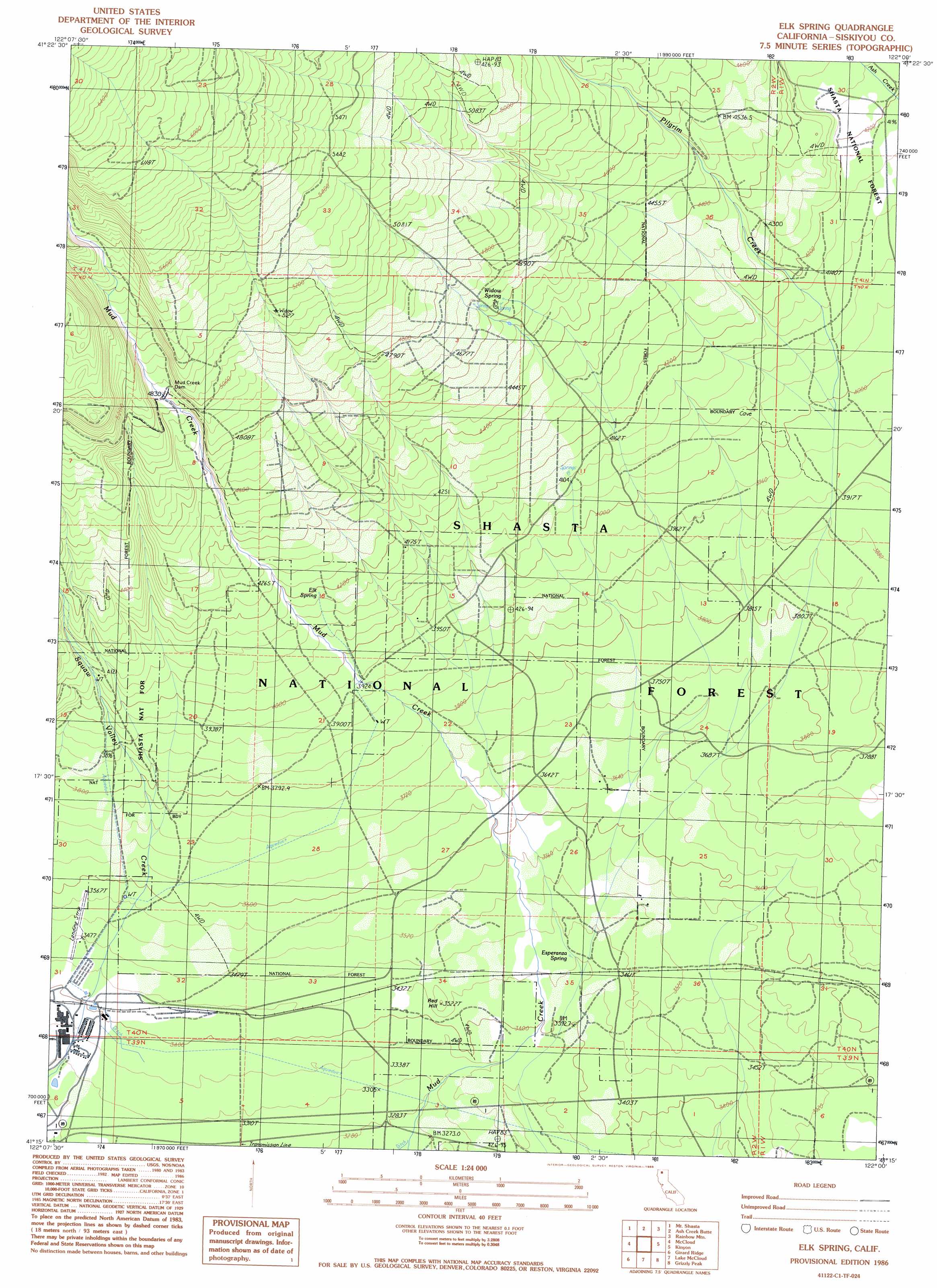
Elk Spring Topo Map California
To zoom in, hover over the map of Elk Spring
USGS Topo Quad 41122c1 - 1:24,000 scale
| Topo Map Name: | Elk Spring |
| USGS Topo Quad ID: | 41122c1 |
| Print Size: | ca. 21 1/4" wide x 27" high |
| Southeast Coordinates: | 41.25° N latitude / 122° W longitude |
| Map Center Coordinates: | 41.3125° N latitude / 122.0625° W longitude |
| U.S. State: | CA |
| Filename: | o41122c1.jpg |
| Download Map JPG Image: | Elk Spring topo map 1:24,000 scale |
| Map Type: | Topographic |
| Topo Series: | 7.5´ |
| Map Scale: | 1:24,000 |
| Source of Map Images: | United States Geological Survey (USGS) |
| Alternate Map Versions: |
Elk Spring CA 1986, updated 1986 Download PDF Buy paper map Elk Spring CA 1998, updated 2003 Download PDF Buy paper map Elk Spring CA 2012 Download PDF Buy paper map Elk Spring CA 2015 Download PDF Buy paper map |
| FStopo: | US Forest Service topo Elk Spring is available: Download FStopo PDF Download FStopo TIF |
1:24,000 Topo Quads surrounding Elk Spring
Juniper Flat |
The Whaleback |
West Haight Mountain |
Tennant |
Garner Mountain |
Hotlum |
Mount Shasta |
Ash Creek Butte |
Rainbow Mountain |
Horse Peak |
City Of Mount Shasta |
Mccloud |
Elk Spring |
Kinyon |
Bartle |
Dunsmuir |
Girard Ridge |
Lake Mccloud |
Grizzly Peak |
Dead Horse Summit |
Tombstone Mountain |
Yellowjacket Mountain |
Shoeinhorse Mountain |
Big Bend |
Skunk Ridge |
> Back to 41122a1 at 1:100,000 scale
> Back to 41122a1 at 1:250,000 scale
> Back to U.S. Topo Maps home
Elk Spring topo map: Gazetteer
Elk Spring: Airports
McCloud Airstrip elevation 1061m 3480′Elk Spring: Dams
Mud Creek Dam elevation 1466m 4809′Elk Spring: Populated Places
Ash Creek Junction elevation 1049m 3441′Esperanza (historical) elevation 1035m 3395′
Elk Spring: Springs
Elk Spring elevation 1277m 4189′Esperanza Spring elevation 1052m 3451′
Widow Spring elevation 1405m 4609′
Elk Spring: Streams
Pilgrim Creek elevation 1216m 3989′Elk Spring: Summits
Red Hill elevation 1075m 3526′Elk Spring digital topo map on disk
Buy this Elk Spring topo map showing relief, roads, GPS coordinates and other geographical features, as a high-resolution digital map file on DVD: