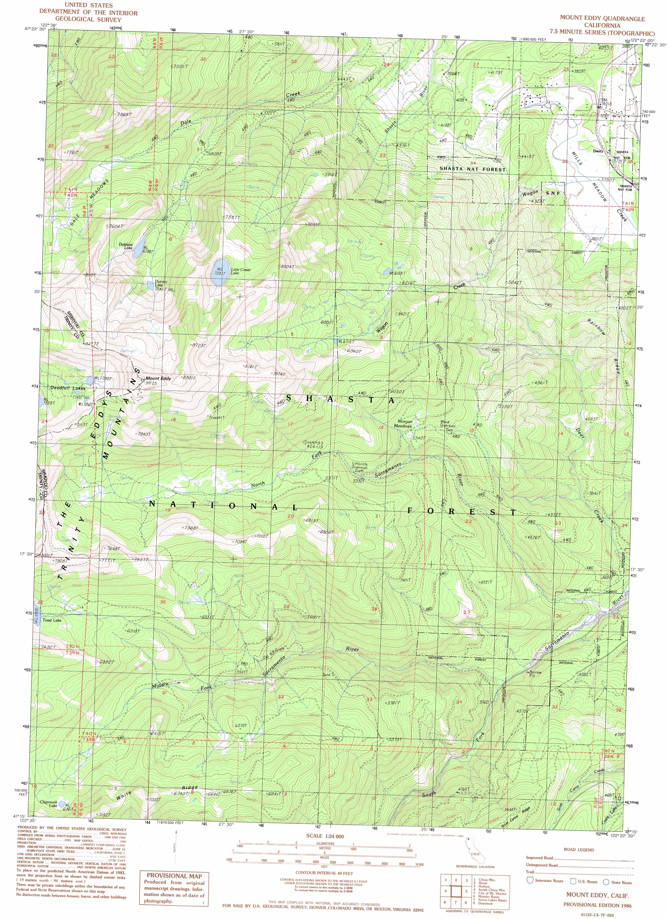
Mount Eddy Topo Map California
To zoom in, hover over the map of Mount Eddy
USGS Topo Quad 41122c4 - 1:24,000 scale
| Topo Map Name: | Mount Eddy |
| USGS Topo Quad ID: | 41122c4 |
| Print Size: | ca. 21 1/4" wide x 27" high |
| Southeast Coordinates: | 41.25° N latitude / 122.375° W longitude |
| Map Center Coordinates: | 41.3125° N latitude / 122.4375° W longitude |
| U.S. State: | CA |
| Filename: | o41122c4.jpg |
| Download Map JPG Image: | Mount Eddy topo map 1:24,000 scale |
| Map Type: | Topographic |
| Topo Series: | 7.5´ |
| Map Scale: | 1:24,000 |
| Source of Map Images: | United States Geological Survey (USGS) |
| Alternate Map Versions: |
Mount Eddy CA 1986, updated 1986 Download PDF Buy paper map Mount Eddy CA 1998, updated 2003 Download PDF Buy paper map Mount Eddy CA 2012 Download PDF Buy paper map Mount Eddy CA 2015 Download PDF Buy paper map |
| FStopo: | US Forest Service topo Mount Eddy is available: Download FStopo PDF Download FStopo TIF |
1:24,000 Topo Quads surrounding Mount Eddy
Duzel Rock |
Gazelle |
Lake Shastina |
Juniper Flat |
The Whaleback |
Gazelle Mountain |
China Mountain |
Weed |
Hotlum |
Mount Shasta |
Scott Mountain |
South China Mountain |
Mount Eddy |
City Of Mount Shasta |
Mccloud |
Tangle Blue Lake |
Mumbo Basin |
Seven Lakes Basin |
Dunsmuir |
Girard Ridge |
Carrville |
Whisky Bill Peak |
Chicken Hawk Hill |
Tombstone Mountain |
Yellowjacket Mountain |
> Back to 41122a1 at 1:100,000 scale
> Back to 41122a1 at 1:250,000 scale
> Back to U.S. Topo Maps home
Mount Eddy topo map: Gazetteer
Mount Eddy: Flats
Dale Meadows elevation 2077m 6814′Mills Meadow elevation 1158m 3799′
Morgan Meadows elevation 1627m 5337′
Mount Eddy: Lakes
Chipmunk Lake elevation 1948m 6391′Dobkins Lake elevation 2070m 6791′
Durney Lake elevation 2153m 7063′
Little Crater Lake elevation 2312m 7585′
Mount Eddy: Populated Places
Deetz elevation 1159m 3802′Mount Eddy: Ranges
Trinity Mountains elevation 2750m 9022′Mount Eddy: Rapids
The Eddys elevation 2314m 7591′Mount Eddy: Ridges
White Ridge elevation 2154m 7066′Mount Eddy: Streams
Middle Fork Sacramento River elevation 1120m 3674′North Fork Sacramento River elevation 1033m 3389′
South Fork Sacramento River elevation 1120m 3674′
Mount Eddy: Summits
Mount Eddy elevation 2751m 9025′Mount Eddy: Trails
Sisson Calahan National Recreation Trail elevation 1840m 6036′Mount Eddy digital topo map on disk
Buy this Mount Eddy topo map showing relief, roads, GPS coordinates and other geographical features, as a high-resolution digital map file on DVD: