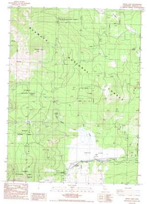
Grass Lake Topo Map California
To zoom in, hover over the map of Grass Lake
USGS Topo Quad 41122f2 - 1:24,000 scale
| Topo Map Name: | Grass Lake |
| USGS Topo Quad ID: | 41122f2 |
| Print Size: | ca. 21 1/4" wide x 27" high |
| Southeast Coordinates: | 41.625° N latitude / 122.125° W longitude |
| Map Center Coordinates: | 41.6875° N latitude / 122.1875° W longitude |
| U.S. State: | CA |
| Filename: | o41122f2.jpg |
| Download Map JPG Image: | Grass Lake topo map 1:24,000 scale |
| Map Type: | Topographic |
| Topo Series: | 7.5´ |
| Map Scale: | 1:24,000 |
| Source of Map Images: | United States Geological Survey (USGS) |
| Alternate Map Versions: |
Grass Lake CA 1986, updated 1986 Download PDF Buy paper map Grass Lake CA 2001, updated 2004 Download PDF Buy paper map Grass Lake CA 2012 Download PDF Buy paper map Grass Lake CA 2015 Download PDF Buy paper map |
| FStopo: | US Forest Service topo Grass Lake is available: Download FStopo PDF Download FStopo TIF |
1:24,000 Topo Quads surrounding Grass Lake
> Back to 41122e1 at 1:100,000 scale
> Back to 41122a1 at 1:250,000 scale
> Back to U.S. Topo Maps home
Grass Lake topo map: Gazetteer
Grass Lake: Flats
Bull Meadow elevation 1628m 5341′Grass Lake: Populated Places
Grass Lake elevation 1538m 5045′Grass Lake: Springs
Bearwallow Spring elevation 1785m 5856′First Spring elevation 1651m 5416′
Grass Lake: Streams
Bear Wallow Creek elevation 1552m 5091′Dairy Creek elevation 1539m 5049′
Grass Lake: Summits
Goosenest elevation 2521m 8270′Herd Peak elevation 2087m 6847′
Miller Mountain elevation 1995m 6545′
Grass Lake: Swamps
Grass Lake elevation 1526m 5006′Grass Lake: Trails
Goosenest Trail elevation 2031m 6663′Grass Lake digital topo map on disk
Buy this Grass Lake topo map showing relief, roads, GPS coordinates and other geographical features, as a high-resolution digital map file on DVD:


