Dewey Gulch Topo Map California
To zoom in, hover over the map of Dewey Gulch
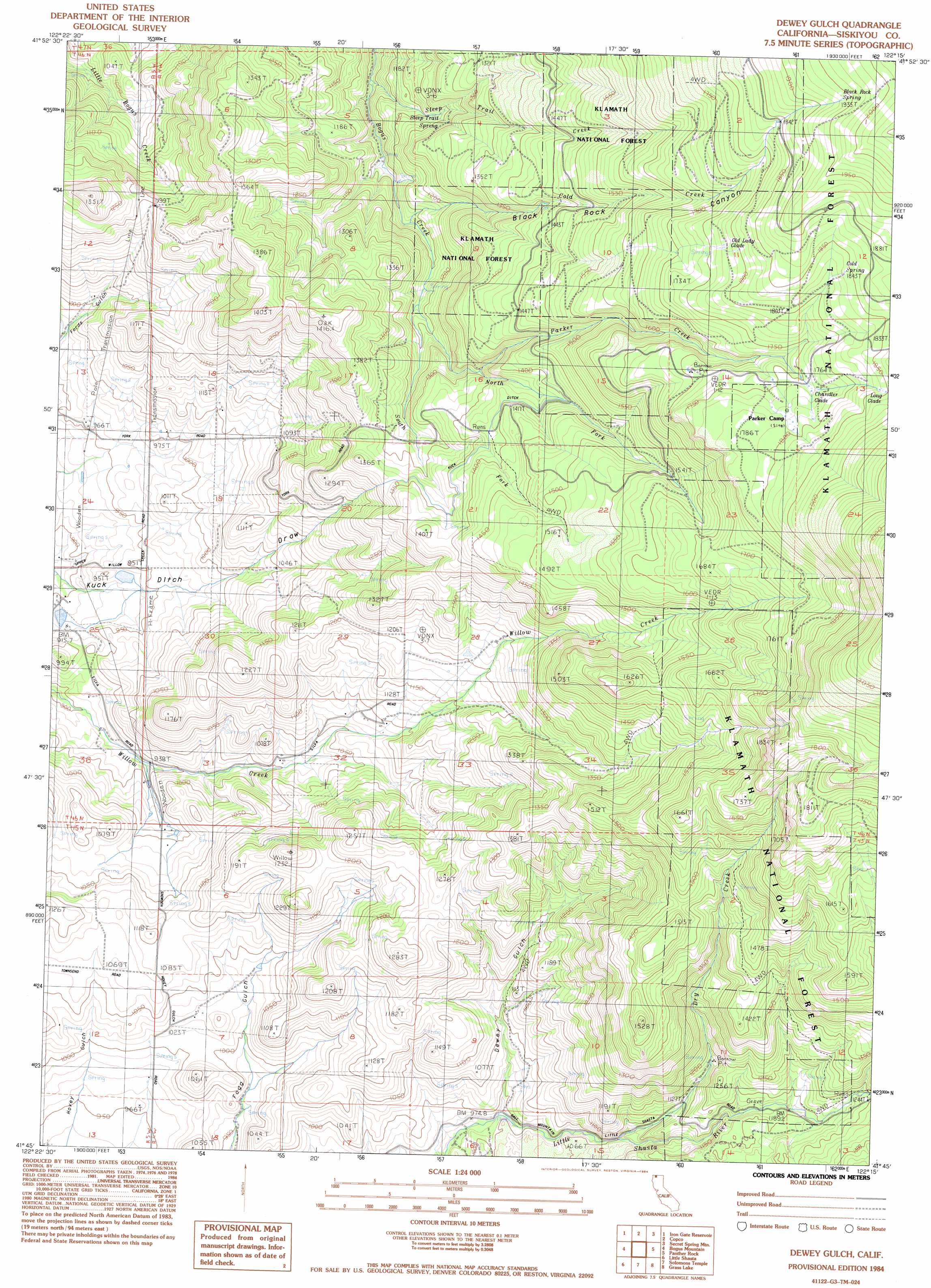
USGS Topo Quad 41122g3 - 1:24,000 scale
| Topo Map Name: | Dewey Gulch |
| USGS Topo Quad ID: | 41122g3 |
| Print Size: | ca. 21 1/4" wide x 27" high |
| Southeast Coordinates: | 41.75° N latitude / 122.25° W longitude |
| Map Center Coordinates: | 41.8125° N latitude / 122.3125° W longitude |
| U.S. State: | CA |
| Filename: | o41122g3.jpg |
| Download Map JPG Image: | Dewey Gulch topo map 1:24,000 scale |
| Map Type: | Topographic |
| Topo Series: | 7.5´ |
| Map Scale: | 1:24,000 |
| Source of Map Images: | United States Geological Survey (USGS) |
| Alternate Map Versions: |
Dewey Gulch CA 1984, updated 1984 Download PDF Buy paper map Dewey Gulch CA 2001, updated 2004 Download PDF Buy paper map Dewey Gulch CA 2001, updated 2004 Download PDF Buy paper map Dewey Gulch CA 2012 Download PDF Buy paper map Dewey Gulch CA 2015 Download PDF Buy paper map |
| FStopo: | US Forest Service topo Dewey Gulch is available: Download FStopo PDF Download FStopo TIF |
1:24,000 Topo Quads surrounding Dewey Gulch
Siskiyou Pass |
Soda Mountain |
Parker Mountain |
Mule Hill |
Chicken Hills |
Hornbrook |
Iron Gate Reservoir |
Copco |
Secret Spring Mountain |
Sams Neck |
Hawkinsville |
Bogus Mountain |
Dewey Gulch |
Panther Rock |
Macdoel |
Montague |
Little Shasta |
Solomons Temple |
Grass Lake |
Penoyar |
Gazelle |
Lake Shastina |
Juniper Flat |
The Whaleback |
West Haight Mountain |
> Back to 41122e1 at 1:100,000 scale
> Back to 41122a1 at 1:250,000 scale
> Back to U.S. Topo Maps home
Dewey Gulch topo map: Gazetteer
Dewey Gulch: Canals
Kuck Ditch elevation 1372m 4501′Dewey Gulch: Flats
Chandler Glade elevation 1764m 5787′Old Lady Glade elevation 1777m 5830′
Dewey Gulch: Mines
Smith Mine elevation 1135m 3723′Dewey Gulch: Springs
Black Rock Spring elevation 1934m 6345′Cold Spring elevation 1846m 6056′
Steep Trail Spring elevation 1193m 3914′
Dewey Gulch: Streams
Cold Creek elevation 1127m 3697′Dry Creek elevation 1066m 3497′
North Fork Bogus Creek elevation 1176m 3858′
Parker Creek elevation 1310m 4297′
South Fork Bogus Creek elevation 1176m 3858′
Steep Trail Creek elevation 1061m 3480′
Dewey Gulch: Swamps
Long Glade elevation 1849m 6066′Dewey Gulch: Trails
Parker Camp Trail elevation 1816m 5958′Dewey Gulch: Valleys
Black Rock Canyon elevation 1121m 3677′Dewey Gulch elevation 993m 3257′
Dewey Gulch digital topo map on disk
Buy this Dewey Gulch topo map showing relief, roads, GPS coordinates and other geographical features, as a high-resolution digital map file on DVD: