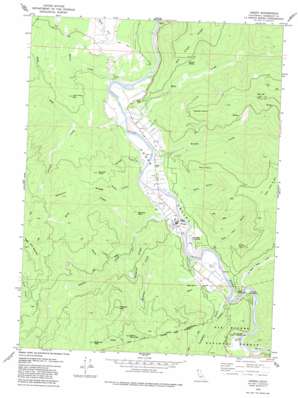
Hoopa Topo Map California
To zoom in, hover over the map of Hoopa
USGS Topo Quad 41123a6 - 1:24,000 scale
| Topo Map Name: | Hoopa |
| USGS Topo Quad ID: | 41123a6 |
| Print Size: | ca. 21 1/4" wide x 27" high |
| Southeast Coordinates: | 41° N latitude / 123.625° W longitude |
| Map Center Coordinates: | 41.0625° N latitude / 123.6875° W longitude |
| U.S. State: | CA |
| Filename: | o41123a6.jpg |
| Download Map JPG Image: | Hoopa topo map 1:24,000 scale |
| Map Type: | Topographic |
| Topo Series: | 7.5´ |
| Map Scale: | 1:24,000 |
| Source of Map Images: | United States Geological Survey (USGS) |
| Alternate Map Versions: |
Hoopa CA 1979, updated 1979 Download PDF Buy paper map Hoopa CA 1979, updated 1983 Download PDF Buy paper map Hoopa CA 1997, updated 2001 Download PDF Buy paper map Hoopa CA 2012 Download PDF Buy paper map Hoopa CA 2015 Download PDF Buy paper map |
| FStopo: | US Forest Service topo Hoopa is available: Download FStopo PDF Download FStopo TIF |
1:24,000 Topo Quads surrounding Hoopa
> Back to 41123a1 at 1:100,000 scale
> Back to 41122a1 at 1:250,000 scale
> Back to U.S. Topo Maps home
Hoopa topo map: Gazetteer
Hoopa: Airports
Hoopa Airport elevation 99m 324′Hoopa: Capes
Ferry Point elevation 638m 2093′Hostler Point elevation 763m 2503′
Jones Point elevation 685m 2247′
Sawmill Point elevation 411m 1348′
Hoopa: Populated Places
Hoopa elevation 100m 328′Hoopa: Ridges
Hospital Ridge elevation 374m 1227′Sawmill Ridge elevation 726m 2381′
Hoopa: Springs
Sixmile Spring elevation 407m 1335′Hoopa: Streams
Beaver Creek elevation 74m 242′Brown Creek elevation 112m 367′
Campbell Creek elevation 94m 308′
Heck Creek elevation 94m 308′
Hospital Creek elevation 97m 318′
Hostler Creek elevation 83m 272′
Mill Creek elevation 77m 252′
North Fork Soctish Creek elevation 203m 666′
Rock Creek elevation 154m 505′
Soctish Creek elevation 75m 246′
Spring Creek elevation 91m 298′
Supply Creek elevation 85m 278′
Tish Tang a Tang Creek elevation 98m 321′
Twomile Creek elevation 256m 839′
Hoopa: Summits
Bald Hill elevation 630m 2066′Big Hill elevation 1072m 3517′
Captain John Mountain elevation 1070m 3510′
Hospital Mountain elevation 1049m 3441′
Lone Pine Mountain elevation 458m 1502′
Snow Mountain elevation 1122m 3681′
Soctish Point elevation 581m 1906′
Sugar Pine Mountain elevation 1174m 3851′
Telescope Peak elevation 1253m 4110′
Hoopa: Valleys
Captain John Gulch elevation 127m 416′Ferry Gulch elevation 152m 498′
Hoopa Valley elevation 76m 249′
Hoopa digital topo map on disk
Buy this Hoopa topo map showing relief, roads, GPS coordinates and other geographical features, as a high-resolution digital map file on DVD:


