Panther Creek Topo Map California
To zoom in, hover over the map of Panther Creek
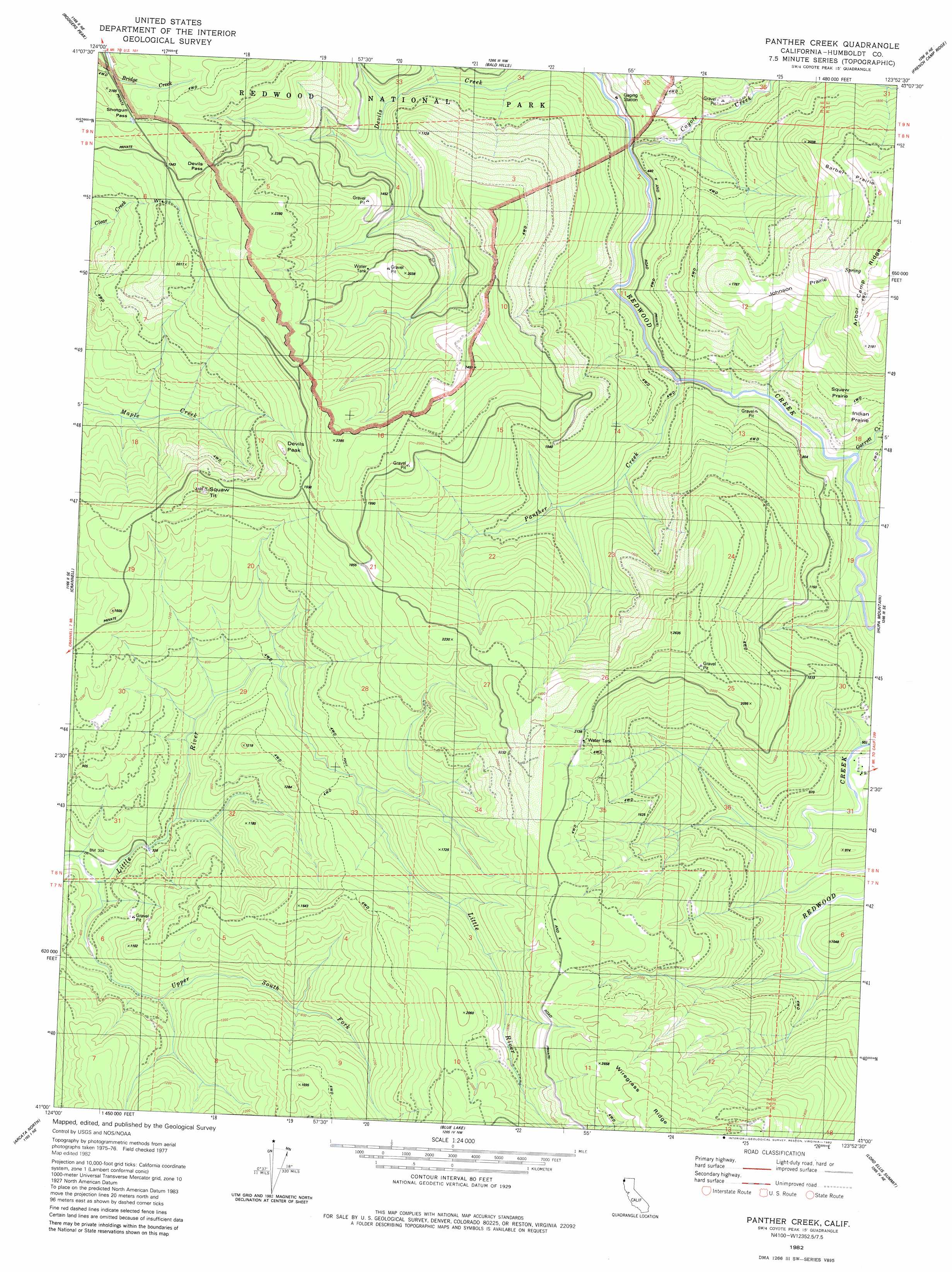
USGS Topo Quad 41123a8 - 1:24,000 scale
| Topo Map Name: | Panther Creek |
| USGS Topo Quad ID: | 41123a8 |
| Print Size: | ca. 21 1/4" wide x 27" high |
| Southeast Coordinates: | 41° N latitude / 123.875° W longitude |
| Map Center Coordinates: | 41.0625° N latitude / 123.9375° W longitude |
| U.S. State: | CA |
| Filename: | o41123a8.jpg |
| Download Map JPG Image: | Panther Creek topo map 1:24,000 scale |
| Map Type: | Topographic |
| Topo Series: | 7.5´ |
| Map Scale: | 1:24,000 |
| Source of Map Images: | United States Geological Survey (USGS) |
| Alternate Map Versions: |
Panther Creek CA 1982, updated 1982 Download PDF Buy paper map Panther Creek CA 2012 Download PDF Buy paper map Panther Creek CA 2015 Download PDF Buy paper map |
1:24,000 Topo Quads surrounding Panther Creek
Orick |
Holter Ridge |
Johnsons |
Fish Lake |
|
Rodgers Peak |
Bald Hills |
French Camp Ridge |
Weitchpec |
|
Trinidad |
Crannell |
Panther Creek |
Hupa Mountain |
Hoopa |
Tyee City |
Arcata North |
Blue Lake |
Lord-Ellis Summit |
Willow Creek |
Eureka |
Arcata South |
Korbel |
Maple Creek |
Grouse Mountain |
> Back to 41123a1 at 1:100,000 scale
> Back to 41122a1 at 1:250,000 scale
> Back to U.S. Topo Maps home
Panther Creek topo map: Gazetteer
Panther Creek: Areas
Barber Prairie elevation 749m 2457′Indian Prairie elevation 279m 915′
Johnson Prairie elevation 759m 2490′
Squaw Prairie elevation 327m 1072′
Panther Creek: Gaps
Devils Pass elevation 630m 2066′Shotgun Pass elevation 632m 2073′
Panther Creek: Streams
Coyote Creek elevation 148m 485′Garrett Creek elevation 132m 433′
Panther Creek elevation 117m 383′
Upper South Fork Little River elevation 96m 314′
Panther Creek: Summits
Devils Peak elevation 616m 2020′Squaw Tit elevation 637m 2089′
Panther Creek digital topo map on disk
Buy this Panther Creek topo map showing relief, roads, GPS coordinates and other geographical features, as a high-resolution digital map file on DVD: