Chimney Rock Topo Map California
To zoom in, hover over the map of Chimney Rock
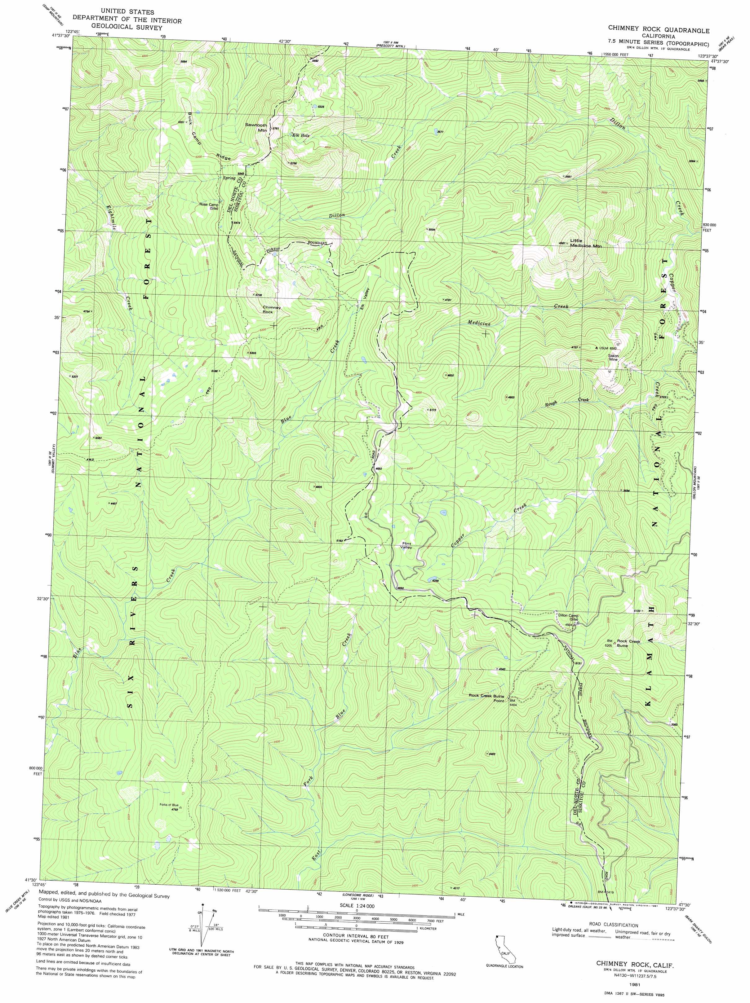
USGS Topo Quad 41123e6 - 1:24,000 scale
| Topo Map Name: | Chimney Rock |
| USGS Topo Quad ID: | 41123e6 |
| Print Size: | ca. 21 1/4" wide x 27" high |
| Southeast Coordinates: | 41.5° N latitude / 123.625° W longitude |
| Map Center Coordinates: | 41.5625° N latitude / 123.6875° W longitude |
| U.S. State: | CA |
| Filename: | o41123e6.jpg |
| Download Map JPG Image: | Chimney Rock topo map 1:24,000 scale |
| Map Type: | Topographic |
| Topo Series: | 7.5´ |
| Map Scale: | 1:24,000 |
| Source of Map Images: | United States Geological Survey (USGS) |
| Alternate Map Versions: |
Chimney Rock CA 1981, updated 1981 Download PDF Buy paper map Chimney Rock CA 1997, updated 2001 Download PDF Buy paper map Chimney Rock CA 2012 Download PDF Buy paper map Chimney Rock CA 2015 Download PDF Buy paper map |
| FStopo: | US Forest Service topo Chimney Rock is available: Download FStopo PDF Download FStopo TIF |
1:24,000 Topo Quads surrounding Chimney Rock
Gasquet |
Hurdygurdy Butte |
Devils Punchbowl |
Preston Peak |
Happy Camp |
Cant Hook Mountain |
Ship Mountain |
Prescott Mountain |
Bear Peak |
Clear Creek |
Klamath Glen |
Summit Valley |
Chimney Rock |
Dillon Mountain |
Ukonom Mountain |
Ah Pah Ridge |
Blue Creek Mountain |
Lonesome Ridge |
Bark Shanty Gulch |
Somes Bar |
Holter Ridge |
Johnsons |
Fish Lake |
Orleans |
Orleans Mountain |
> Back to 41123e1 at 1:100,000 scale
> Back to 41122a1 at 1:250,000 scale
> Back to U.S. Topo Maps home
Chimney Rock topo map: Gazetteer
Chimney Rock: Basins
Flint Valley elevation 1390m 4560′Chimney Rock: Capes
Rock Creek Butte Point elevation 1334m 4376′Chimney Rock: Lakes
Elk Hole elevation 1517m 4977′Flatiron Lake elevation 1531m 5022′
Chimney Rock: Mines
Siskon Mine elevation 1092m 3582′Chimney Rock: Pillars
Chimney Rock elevation 1738m 5702′Chimney Rock: Ridges
Buck Camp Ridge elevation 1613m 5291′Chimney Rock: Streams
Copper Creek elevation 570m 1870′Medicine Creek elevation 603m 1978′
Rough Creek elevation 701m 2299′
Chimney Rock: Summits
Little Medicine Mountain elevation 1517m 4977′Rock Creek Butte elevation 1579m 5180′
Sawtooth Mountain elevation 1758m 5767′
Chimney Rock: Valleys
Elk Valley elevation 1251m 4104′Chimney Rock digital topo map on disk
Buy this Chimney Rock topo map showing relief, roads, GPS coordinates and other geographical features, as a high-resolution digital map file on DVD: