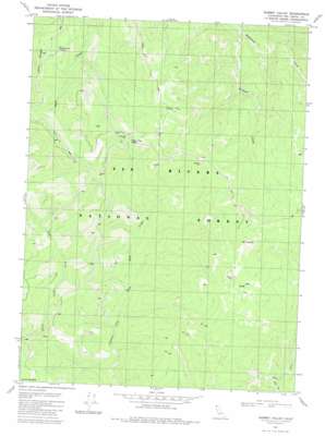
Summit Valley Topo Map California
To zoom in, hover over the map of Summit Valley
USGS Topo Quad 41123e7 - 1:24,000 scale
| Topo Map Name: | Summit Valley |
| USGS Topo Quad ID: | 41123e7 |
| Print Size: | ca. 21 1/4" wide x 27" high |
| Southeast Coordinates: | 41.5° N latitude / 123.75° W longitude |
| Map Center Coordinates: | 41.5625° N latitude / 123.8125° W longitude |
| U.S. State: | CA |
| Filename: | o41123e7.jpg |
| Download Map JPG Image: | Summit Valley topo map 1:24,000 scale |
| Map Type: | Topographic |
| Topo Series: | 7.5´ |
| Map Scale: | 1:24,000 |
| Source of Map Images: | United States Geological Survey (USGS) |
| Alternate Map Versions: |
Summit Valley CA 1981, updated 1982 Download PDF Buy paper map Summit Valley CA 1997, updated 2001 Download PDF Buy paper map Summit Valley CA 2012 Download PDF Buy paper map Summit Valley CA 2015 Download PDF Buy paper map |
| FStopo: | US Forest Service topo Summit Valley is available: Download FStopo PDF Download FStopo TIF |
1:24,000 Topo Quads surrounding Summit Valley
> Back to 41123e1 at 1:100,000 scale
> Back to 41122a1 at 1:250,000 scale
> Back to U.S. Topo Maps home
Summit Valley topo map: Gazetteer
Summit Valley: Basins
Summit Valley elevation 1493m 4898′Summit Valley: Pillars
Doctor Rock elevation 1443m 4734′Summit Valley: Populated Places
Peak Eight elevation 1570m 5150′Summit Valley: Ridges
Lems Ridge elevation 1138m 3733′Summit Valley: Springs
Cedar Camp Spring elevation 1207m 3959′Wooley Bear Spring elevation 1066m 3497′
Summit Valley: Streams
East Fork Blue Creek elevation 546m 1791′Williams Creek elevation 462m 1515′
Summit Valley: Trails
Summit Valley Trail elevation 1297m 4255′Summit Valley digital topo map on disk
Buy this Summit Valley topo map showing relief, roads, GPS coordinates and other geographical features, as a high-resolution digital map file on DVD:


