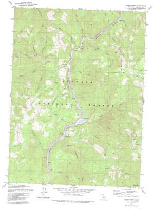
Clear Creek Topo Map California
To zoom in, hover over the map of Clear Creek
USGS Topo Quad 41123f4 - 1:24,000 scale
| Topo Map Name: | Clear Creek |
| USGS Topo Quad ID: | 41123f4 |
| Print Size: | ca. 21 1/4" wide x 27" high |
| Southeast Coordinates: | 41.625° N latitude / 123.375° W longitude |
| Map Center Coordinates: | 41.6875° N latitude / 123.4375° W longitude |
| U.S. State: | CA |
| Filename: | o41123f4.jpg |
| Download Map JPG Image: | Clear Creek topo map 1:24,000 scale |
| Map Type: | Topographic |
| Topo Series: | 7.5´ |
| Map Scale: | 1:24,000 |
| Source of Map Images: | United States Geological Survey (USGS) |
| Alternate Map Versions: |
Clear Creek CA 1981, updated 1981 Download PDF Buy paper map Clear Creek CA 1981, updated 1981 Download PDF Buy paper map Clear Creek CA 2001, updated 2004 Download PDF Buy paper map Clear Creek CA 2012 Download PDF Buy paper map Clear Creek CA 2015 Download PDF Buy paper map |
| FStopo: | US Forest Service topo Clear Creek is available: Download FStopo PDF Download FStopo TIF |
1:24,000 Topo Quads surrounding Clear Creek
> Back to 41123e1 at 1:100,000 scale
> Back to 41122a1 at 1:250,000 scale
> Back to U.S. Topo Maps home
Clear Creek topo map: Gazetteer
Clear Creek: Bars
Attebery Bar elevation 271m 889′Wingate Bar elevation 288m 944′
Clear Creek: Bridges
Thornton Memorial Bridge elevation 257m 843′Clear Creek: Cliffs
Ferry Point elevation 296m 971′Clear Creek: Gaps
Titus Gap elevation 924m 3031′Clear Creek: Mines
Bunker Hill Mine elevation 380m 1246′Buzzard Hill Mine elevation 466m 1528′
Independence Mine elevation 378m 1240′
Kanaka Hill Mine elevation 348m 1141′
Siskiyou Mine elevation 411m 1348′
Clear Creek: Populated Places
Clear Creek elevation 297m 974′Ferry Point (historical) elevation 301m 987′
Clear Creek: Ridges
Baldy Mountain Ridge elevation 1222m 4009′Clear Creek: Streams
Browns Creek elevation 269m 882′Buzzard Creek elevation 289m 948′
Clear Creek elevation 281m 921′
Crawford Creek elevation 258m 846′
Daggett Creek elevation 329m 1079′
Doolittle Creek elevation 295m 967′
Douglas Creek elevation 271m 889′
Dutch Creek elevation 314m 1030′
Fourmile Creek elevation 365m 1197′
Independence Creek elevation 262m 859′
Kanaka Creek elevation 309m 1013′
Middle Fork Titus Creek elevation 368m 1207′
Oak Flat Creek elevation 281m 921′
South Fork Clear Creek elevation 367m 1204′
Tinkham Creek elevation 302m 990′
Titus Creek elevation 271m 889′
U-Fish Creek elevation 308m 1010′
Wilson Creek elevation 294m 964′
Wingate Creek elevation 281m 921′
Clear Creek: Trails
Titus Ridge Trail elevation 912m 2992′Clear Creek: Valleys
Coon Hollow elevation 466m 1528′Gasquet Gulch elevation 356m 1167′
Phillips Gulch elevation 563m 1847′
Clear Creek digital topo map on disk
Buy this Clear Creek topo map showing relief, roads, GPS coordinates and other geographical features, as a high-resolution digital map file on DVD:


