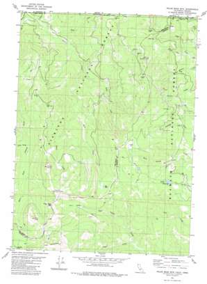
Polar Bear Mountain Topo Map California
To zoom in, hover over the map of Polar Bear Mountain
USGS Topo Quad 41123h5 - 1:24,000 scale
| Topo Map Name: | Polar Bear Mountain |
| USGS Topo Quad ID: | 41123h5 |
| Print Size: | ca. 21 1/4" wide x 27" high |
| Southeast Coordinates: | 41.875° N latitude / 123.5° W longitude |
| Map Center Coordinates: | 41.9375° N latitude / 123.5625° W longitude |
| U.S. States: | CA, OR |
| Filename: | o41123h5.jpg |
| Download Map JPG Image: | Polar Bear Mountain topo map 1:24,000 scale |
| Map Type: | Topographic |
| Topo Series: | 7.5´ |
| Map Scale: | 1:24,000 |
| Source of Map Images: | United States Geological Survey (USGS) |
| Alternate Map Versions: |
Polar Bear Mountain CA 1982, updated 1982 Download PDF Buy paper map Polar Bear Mountain CA 1996, updated 1999 Download PDF Buy paper map Polar Bear Mountain CA 2012 Download PDF Buy paper map Polar Bear Mountain CA 2015 Download PDF Buy paper map |
| FStopo: | US Forest Service topo Polar Bear Mountain is available: Download FStopo PDF Download FStopo TIF |
1:24,000 Topo Quads surrounding Polar Bear Mountain
> Back to 41123e1 at 1:100,000 scale
> Back to 41122a1 at 1:250,000 scale
> Back to U.S. Topo Maps home
Polar Bear Mountain topo map: Gazetteer
Polar Bear Mountain: Falls
Loretta Falls elevation 1491m 4891′Polar Bear Mountain: Flats
Poker Flat elevation 1532m 5026′Polar Bear Mountain: Lakes
Kelly Lake elevation 1332m 4370′Mud Lake elevation 1489m 4885′
Polar Bear Mountain: Mines
Orloff Mine elevation 1430m 4691′Polar Bear Mountain: Streams
Black Creek elevation 936m 3070′Copper Creek elevation 788m 2585′
Dunn Creek elevation 552m 1811′
Louse Creek elevation 1019m 3343′
North Fork Dunn Creek elevation 598m 1961′
North Fork Dunn Creek elevation 598m 1961′
Packers Creek elevation 569m 1866′
Packers Creek elevation 569m 1866′
Poker Creek elevation 683m 2240′
Polar Bear Mountain: Summits
Bear Cub elevation 1833m 6013′Black Butte elevation 1826m 5990′
Crazy Peak elevation 1566m 5137′
Little Grayback elevation 1867m 6125′
Lookout Mountain elevation 1920m 6299′
Polar Bear Mountain elevation 1906m 6253′
The Lieutenants elevation 1878m 6161′
Polar Bear Mountain: Valleys
Sanger Canyon elevation 1097m 3599′Twin Valley elevation 1008m 3307′
Polar Bear Mountain digital topo map on disk
Buy this Polar Bear Mountain topo map showing relief, roads, GPS coordinates and other geographical features, as a high-resolution digital map file on DVD:


