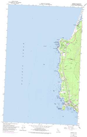
Trinidad Topo Map California
To zoom in, hover over the map of Trinidad
USGS Topo Quad 41124a2 - 1:24,000 scale
| Topo Map Name: | Trinidad |
| USGS Topo Quad ID: | 41124a2 |
| Print Size: | ca. 21 1/4" wide x 27" high |
| Southeast Coordinates: | 41° N latitude / 124.125° W longitude |
| Map Center Coordinates: | 41.0625° N latitude / 124.1875° W longitude |
| U.S. State: | CA |
| Filename: | o41124a2.jpg |
| Download Map JPG Image: | Trinidad topo map 1:24,000 scale |
| Map Type: | Topographic |
| Topo Series: | 7.5´ |
| Map Scale: | 1:24,000 |
| Source of Map Images: | United States Geological Survey (USGS) |
| Alternate Map Versions: |
Trinidad CA 2012 Download PDF Buy paper map Trinidad CA 2015 Download PDF Buy paper map |
1:24,000 Topo Quads surrounding Trinidad
Orick |
Holter Ridge |
|||
Rodgers Peak |
Bald Hills |
|||
Trinidad |
Crannell |
Panther Creek |
||
Tyee City |
Arcata North |
Blue Lake |
||
Eureka |
Arcata South |
Korbel |
> Back to 41124a1 at 1:100,000 scale
> Back to 41124a1 at 1:250,000 scale
> Back to U.S. Topo Maps home
Trinidad topo map: Gazetteer
Trinidad: Bays
College Cove elevation 0m 0′Trinidad Bay elevation 0m 0′
Trinidad: Capes
Megwil Point elevation 10m 32′Omenoku Point elevation 18m 59′
Scotty Point elevation 10m 32′
Sotsin Point elevation 37m 121′
Trinidad Head elevation 3m 9′
Trinidad: Cliffs
Elk Head elevation 4m 13′Little Head elevation 17m 55′
Trinidad: Harbors
Trinidad Harbor elevation 3m 9′Trinidad: Islands
Blank Rock elevation 28m 91′Camal Rock elevation 0m 0′
Camel Rock elevation 0m 0′
Cap Rock elevation 0m 0′
Cone Rock elevation 0m 0′
Flat Rock elevation 0m 0′
Flatiron Rock elevation 13m 42′
Green Rock elevation 25m 82′
Lepoil Rock elevation 0m 0′
Pewetole Island elevation 44m 144′
Pilot Rock elevation 2m 6′
Prisoner Rock elevation 12m 39′
White Rock elevation 9m 29′
Trinidad: Parks
Trinidad State Beach elevation 4m 13′Trinidad: Populated Places
Patricks Point elevation 73m 239′Trinidad elevation 53m 173′
Tsurau (historical) elevation 53m 173′
Trinidad: Streams
Burris Creek elevation 1m 3′McConnahas Mill Creek elevation 0m 0′
McNeil Creek elevation 5m 16′
Mill Creek elevation 0m 0′
Savage Creek elevation 4m 13′
Trinidad: Summits
Candy Mountain elevation 268m 879′Trinidad: Trails
Tsurai Trail elevation 98m 321′Trinidad digital topo map on disk
Buy this Trinidad topo map showing relief, roads, GPS coordinates and other geographical features, as a high-resolution digital map file on DVD:


