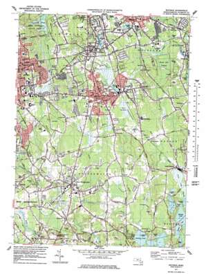
Whitman Topo Map Massachusetts
To zoom in, hover over the map of Whitman
USGS Topo Quad 42070a8 - 1:25,000 scale
| Topo Map Name: | Whitman |
| USGS Topo Quad ID: | 42070a8 |
| Print Size: | ca. 21 1/4" wide x 27" high |
| Southeast Coordinates: | 42° N latitude / 70.875° W longitude |
| Map Center Coordinates: | 42.0625° N latitude / 70.9375° W longitude |
| U.S. State: | MA |
| Filename: | l42070a8.jpg |
| Download Map JPG Image: | Whitman topo map 1:25,000 scale |
| Map Type: | Topographic |
| Topo Series: | 7.5´ |
| Map Scale: | 1:25,000 |
| Source of Map Images: | United States Geological Survey (USGS) |
| Alternate Map Versions: |
Whitman MA 1977, updated 1979 Download PDF Buy paper map Whitman MA 1977, updated 1979 Download PDF Buy paper map Whitman MA 1977, updated 1981 Download PDF Buy paper map |
1:24,000 Topo Quads surrounding Whitman
Boston South |
Nantasket Beach |
|||
Blue Hills |
Cohasset |
|||
Brockton |
Whitman |
Hanover |
Duxbury |
|
Taunton |
Bridgewater |
Plympton |
Plymouth |
|
Assonet |
Assawompset Pond |
Snipatuit Pond |
Wareham |
> Back to 42070a1 at 1:100,000 scale
> Back to 42070a1 at 1:250,000 scale
> Back to U.S. Topo Maps home
Whitman topo map: Gazetteer
Whitman: Dams
Burrage Pond Lower Reservoir Dike A elevation 17m 55′Burrage Pond Lower Reservoir Dike B elevation 17m 55′
Cleveland Pond Dam elevation 41m 134′
Cotton Gin Pond Dam elevation 11m 36′
Forge Pond Dam elevation 16m 52′
Forge Pond Dam elevation 17m 55′
High Street - North Side Dam elevation 11m 36′
Hunts Pond Dam elevation 37m 121′
Indian Trail Reservoir Number Three Dam elevation 19m 62′
Indian Trail Reservoir Number Two Dam elevation 19m 62′
Island Grove Pond Dam elevation 27m 88′
Robbins Reservoir Dam elevation 14m 45′
Studleys Pond Dam elevation 31m 101′
Stump Pond Dam elevation 15m 49′
Town River Dam elevation 11m 36′
Whitman: Flats
Hobart Meadow elevation 22m 72′Whitman: Forests
Whitman Town Forest elevation 28m 91′Whitman: Islands
Osceola Island elevation 12m 39′Whitman: Lakes
Cushing Pond elevation 21m 68′Hobart Pond elevation 22m 72′
Jones Pond elevation 22m 72′
Whitman: Parks
Ames Nowell State Park elevation 48m 157′Island Grove Park elevation 30m 98′
Whitman: Populated Places
Abington elevation 32m 104′Auburnville elevation 35m 114′
Beaver elevation 24m 78′
Coxs Corner elevation 27m 88′
Curtisville elevation 14m 45′
Drumlin Farms elevation 41m 134′
East Bridgewater elevation 22m 72′
Eastville elevation 18m 59′
Elmwood elevation 24m 78′
Elmwood Station elevation 20m 65′
Hanson elevation 30m 98′
Matfield elevation 27m 88′
Matfield Junction elevation 20m 65′
North Hanson elevation 16m 52′
Northville elevation 34m 111′
Rye Hill elevation 45m 147′
Satucket elevation 17m 55′
South Hanson elevation 28m 91′
Stanley elevation 14m 45′
West Abington elevation 49m 160′
West Hanover elevation 21m 68′
Westdale elevation 24m 78′
Whitman elevation 36m 118′
Winslow Estates elevation 35m 114′
Whitman: Post Offices
Abington Post Office (historical) elevation 33m 108′East Bridgewater Post Office (historical) elevation 17m 55′
Elmwood Post Office (historical) elevation 16m 52′
Matfield Post Office (historical) elevation 22m 72′
North Hanson Post Office (historical) elevation 21m 68′
South Hanson Post Office (historical) elevation 25m 82′
Westdale Post Office (historical) elevation 24m 78′
Whitman Post Office (historical) elevation 37m 121′
Whitman: Reservoirs
Burrage Pond - Lower Reservoir elevation 17m 55′Cleveland Pond elevation 41m 134′
Forge Pond elevation 18m 59′
Forge Pond elevation 16m 52′
Hardings Pond elevation 44m 144′
Hunts Pond elevation 37m 121′
Indian Trail Number Three Reservoir elevation 19m 62′
Indian Trail Reservoir elevation 19m 62′
Island Grove Pond elevation 27m 88′
Robbins Pond elevation 14m 45′
Sawtucket River Reservoir elevation 11m 36′
Studleys Pond elevation 31m 101′
Stump Pond elevation 15m 49′
Town River Reservoir elevation 11m 36′
Town River Reservoir elevation 11m 36′
Whitman: Streams
Beaver Brook elevation 13m 42′Black Brook elevation 12m 39′
Cushing Brook elevation 16m 52′
French Stream elevation 15m 49′
Leach Brook elevation 35m 114′
Meadow Brook elevation 11m 36′
Poor Meadow Brook elevation 13m 42′
Salisbury Plain River elevation 13m 42′
Satucket River elevation 7m 22′
Shumatuscacant River elevation 16m 52′
Stream River elevation 23m 75′
Whitman: Summits
Beech Hill elevation 57m 187′Bonney Hill elevation 48m 157′
Locust Hill elevation 62m 203′
Roundtop elevation 34m 111′
Rye Hill elevation 46m 150′
Spragues Hill elevation 41m 134′
Whitman: Swamps
Bear Meadow elevation 20m 65′Beech Hill Swamp elevation 19m 62′
Whitman digital topo map on disk
Buy this Whitman topo map showing relief, roads, GPS coordinates and other geographical features, as a high-resolution digital map file on DVD:
Maine, New Hampshire, Rhode Island & Eastern Massachusetts
Buy digital topo maps: Maine, New Hampshire, Rhode Island & Eastern Massachusetts


