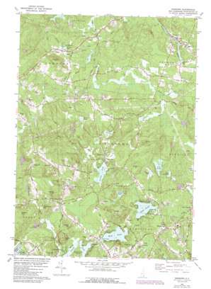
Sandown Topo Map New Hampshire
To zoom in, hover over the map of Sandown
USGS Topo Quad 42071h2 - 1:24,000 scale
| Topo Map Name: | Sandown |
| USGS Topo Quad ID: | 42071h2 |
| Print Size: | ca. 21 1/4" wide x 27" high |
| Southeast Coordinates: | 42.875° N latitude / 71.125° W longitude |
| Map Center Coordinates: | 42.9375° N latitude / 71.1875° W longitude |
| U.S. State: | NH |
| Filename: | o42071h2.jpg |
| Download Map JPG Image: | Sandown topo map 1:24,000 scale |
| Map Type: | Topographic |
| Topo Series: | 7.5´ |
| Map Scale: | 1:24,000 |
| Source of Map Images: | United States Geological Survey (USGS) |
| Alternate Map Versions: |
Sandown NH 1981, updated 1981 Download PDF Buy paper map Sandown NH 1981, updated 1989 Download PDF Buy paper map Sandown NH 1981, updated 1989 Download PDF Buy paper map Sandown NH 2012 Download PDF Buy paper map Sandown NH 2015 Download PDF Buy paper map |
1:24,000 Topo Quads surrounding Sandown
> Back to 42071e1 at 1:100,000 scale
> Back to 42070a1 at 1:250,000 scale
> Back to U.S. Topo Maps home
Sandown topo map: Gazetteer
Sandown: Airports
Heaton Airport elevation 55m 180′Sandown: Dams
Angle Pond Dam elevation 69m 226′Ballard Pond Dam Omitted elevation 78m 255′
Ballard Pond Upper Dam elevation 79m 259′
Little Cub Pond Dam elevation 66m 216′
Wash Pond Dam elevation 74m 242′
Wason Pond Dam elevation 64m 209′
Sandown: Lakes
Cub Pond elevation 65m 213′Diamond Pond elevation 59m 193′
Hunt Pond elevation 74m 242′
Lily Pond elevation 63m 206′
Phillips Pond elevation 65m 213′
Punch Pond elevation 77m 252′
Showell Pond elevation 68m 223′
Wash Pond elevation 71m 232′
Sandown: Populated Places
Baglett Grove elevation 84m 275′Collettes Grove elevation 64m 209′
East Hampstead elevation 76m 249′
Fremont elevation 47m 154′
Hubbard elevation 80m 262′
Sandown elevation 69m 226′
South Danville elevation 66m 216′
West Hampstead elevation 85m 278′
Sandown: Post Offices
Sandown Post Office elevation 71m 232′Sandown: Reservoirs
Angle Pond elevation 69m 226′Ballard Pond elevation 79m 259′
Little Cub Pond elevation 66m 216′
Lower Ballard Pond elevation 78m 255′
Wash Pond elevation 74m 242′
Wason Pond elevation 64m 209′
Sandown: Streams
Cunningham Brook elevation 62m 203′Fordway Brook elevation 48m 157′
Leavitt Brook elevation 62m 203′
Wilson Brook elevation 93m 305′
Sandown: Summits
Bond Hill elevation 106m 347′Butman Hill elevation 145m 475′
Chestnut Hill elevation 112m 367′
Cunningham Hill elevation 110m 360′
Eastman Hill elevation 134m 439′
French Hill elevation 113m 370′
Great Hill elevation 130m 426′
Howe Hill elevation 119m 390′
Hoyt Hill elevation 147m 482′
King Hill elevation 132m 433′
Mardens Hill elevation 125m 410′
Osgood Hill elevation 111m 364′
Smith Mountain elevation 123m 403′
Walnut Hill elevation 167m 547′
Wilson Hill elevation 128m 419′
Sandown digital topo map on disk
Buy this Sandown topo map showing relief, roads, GPS coordinates and other geographical features, as a high-resolution digital map file on DVD:
Maine, New Hampshire, Rhode Island & Eastern Massachusetts
Buy digital topo maps: Maine, New Hampshire, Rhode Island & Eastern Massachusetts


