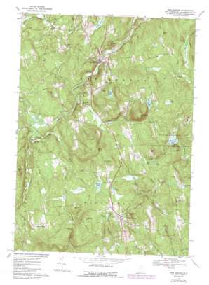
New Boston Topo Map New Hampshire
To zoom in, hover over the map of New Boston
USGS Topo Quad 42071h6 - 1:24,000 scale
| Topo Map Name: | New Boston |
| USGS Topo Quad ID: | 42071h6 |
| Print Size: | ca. 21 1/4" wide x 27" high |
| Southeast Coordinates: | 42.875° N latitude / 71.625° W longitude |
| Map Center Coordinates: | 42.9375° N latitude / 71.6875° W longitude |
| U.S. State: | NH |
| Filename: | o42071h6.jpg |
| Download Map JPG Image: | New Boston topo map 1:24,000 scale |
| Map Type: | Topographic |
| Topo Series: | 7.5´ |
| Map Scale: | 1:24,000 |
| Source of Map Images: | United States Geological Survey (USGS) |
| Alternate Map Versions: |
New Boston NH 1968, updated 1971 Download PDF Buy paper map New Boston NH 1968, updated 1985 Download PDF Buy paper map New Boston NH 1968, updated 1988 Download PDF Buy paper map New Boston NH 1995, updated 1999 Download PDF Buy paper map New Boston NH 2012 Download PDF Buy paper map New Boston NH 2015 Download PDF Buy paper map |
1:24,000 Topo Quads surrounding New Boston
> Back to 42071e1 at 1:100,000 scale
> Back to 42070a1 at 1:250,000 scale
> Back to U.S. Topo Maps home
New Boston topo map: Gazetteer
New Boston: Airports
Austins Landing Heliport elevation 178m 583′Huff Memorial Airport elevation 259m 849′
New Boston: Dams
Fearon Farm Pond Dam elevation 193m 633′New Boston: Falls
Purgatory Falls elevation 182m 597′New Boston: Lakes
Bailey Pond elevation 222m 728′Bate Pond elevation 203m 666′
Beaver Dam Pond elevation 238m 780′
Campbell Pond elevation 154m 505′
Colby Pond elevation 164m 538′
Dodge Pond elevation 154m 505′
Glen Echo Pond elevation 188m 616′
Hortons Pond elevation 219m 718′
Ice Pond elevation 234m 767′
Jew Pond elevation 246m 807′
Joe English Pond elevation 153m 501′
Mayberry Pond elevation 176m 577′
McGregors Pond elevation 155m 508′
Roby Pond elevation 240m 787′
Sandhill Pond elevation 177m 580′
Shaky Pond elevation 242m 793′
Stearns Pond elevation 221m 725′
New Boston: Populated Places
Johnson Corner elevation 221m 725′Mont Vernon elevation 250m 820′
New Boston elevation 135m 442′
New Boston: Post Offices
Mont Vernon Post Office elevation 250m 820′New Boston: Reservoirs
Fearon Farm Pond elevation 193m 633′Woods Pond elevation 234m 767′
New Boston: Streams
Black Brook elevation 209m 685′Cold Brook elevation 155m 508′
Curtis Brook elevation 122m 400′
Lords Brook elevation 152m 498′
Meadow Brook elevation 147m 482′
New Boston: Summits
Beech Hill elevation 261m 856′Clark Hill elevation 236m 774′
Cochran Hill elevation 228m 748′
Hooper Hill elevation 247m 810′
Joe English Hill elevation 388m 1272′
McCollom Hill elevation 278m 912′
Meetinghouse Hill elevation 262m 859′
Pinball Hill elevation 207m 679′
Prospect Hill elevation 268m 879′
Purgatory Hill elevation 268m 879′
Roby Hill elevation 301m 987′
South Hill elevation 313m 1026′
Storey Hill elevation 309m 1013′
Wilson Hill elevation 232m 761′
New Boston: Swamps
Campbell Swamp elevation 154m 505′New Boston: Trails
Old Country Road elevation 200m 656′New Boston digital topo map on disk
Buy this New Boston topo map showing relief, roads, GPS coordinates and other geographical features, as a high-resolution digital map file on DVD:
Maine, New Hampshire, Rhode Island & Eastern Massachusetts
Buy digital topo maps: Maine, New Hampshire, Rhode Island & Eastern Massachusetts


