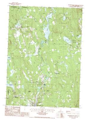
Peterborough North Topo Map New Hampshire
To zoom in, hover over the map of Peterborough North
USGS Topo Quad 42071h8 - 1:24,000 scale
| Topo Map Name: | Peterborough North |
| USGS Topo Quad ID: | 42071h8 |
| Print Size: | ca. 21 1/4" wide x 27" high |
| Southeast Coordinates: | 42.875° N latitude / 71.875° W longitude |
| Map Center Coordinates: | 42.9375° N latitude / 71.9375° W longitude |
| U.S. State: | NH |
| Filename: | o42071h8.jpg |
| Download Map JPG Image: | Peterborough North topo map 1:24,000 scale |
| Map Type: | Topographic |
| Topo Series: | 7.5´ |
| Map Scale: | 1:24,000 |
| Source of Map Images: | United States Geological Survey (USGS) |
| Alternate Map Versions: |
Peterborough North NH 1987, updated 1987 Download PDF Buy paper map Peterborough North NH 1997, updated 1998 Download PDF Buy paper map Peterborough North NH 2012 Download PDF Buy paper map Peterborough North NH 2015 Download PDF Buy paper map |
1:24,000 Topo Quads surrounding Peterborough North
> Back to 42071e1 at 1:100,000 scale
> Back to 42070a1 at 1:250,000 scale
> Back to U.S. Topo Maps home
Peterborough North topo map: Gazetteer
Peterborough North: Beaches
Campers Beach elevation 249m 816′Picnickers Beach elevation 247m 810′
Peterborough North: Bridges
Hancock-Greenfield Bridge elevation 206m 675′Peterborough North: Dams
Edward MacDowell Dam elevation 284m 931′Mill Race Dam elevation 259m 849′
North Village Dam elevation 215m 705′
Peterborough Treatment Lagoons Dam elevation 210m 688′
Powder Mill Pond Dam elevation 206m 675′
Whittemore Lake Dam elevation 251m 823′
Peterborough North: Forests
Shieling State Forest elevation 256m 839′Peterborough North: Lakes
Halfmoon Pond elevation 288m 944′Hogback Pond elevation 247m 810′
Mud Pond elevation 256m 839′
Norway Pond elevation 253m 830′
Otter Lake elevation 245m 803′
Sunset Lake elevation 265m 869′
Peterborough North: Parks
Evas Marsh State Wildlife Management Area elevation 282m 925′Greenfield State Park elevation 270m 885′
The Common elevation 217m 711′
Peterborough North: Populated Places
Elmwood elevation 238m 780′Hancock elevation 266m 872′
Happy Valley elevation 220m 721′
MacDowell Colony elevation 278m 912′
North Village elevation 217m 711′
West Peterborough elevation 264m 866′
Peterborough North: Post Offices
Hancock Post Office elevation 259m 849′Peterborough Post Office elevation 222m 728′
Peterborough North: Reservoirs
Beaver Pond elevation 246m 807′Contoocook River Reservoir elevation 215m 705′
Edward MacDowell Reservoir elevation 284m 931′
Otter Brook Pond elevation 259m 849′
Powder Mill Pond elevation 206m 675′
Whittemore Lake elevation 251m 823′
Peterborough North: Streams
Brush Brook elevation 278m 912′Davis Brook elevation 224m 734′
Ferguson Brook elevation 207m 679′
Hosley Brook elevation 224m 734′
Kimbatt Brook elevation 206m 675′
Moose Brook elevation 206m 675′
Nubanusit Brook elevation 219m 718′
Otter Brook elevation 208m 682′
Peterborough North: Summits
Norway Hill elevation 343m 1125′Peterborough North: Swamps
Spruce Swamp elevation 247m 810′West Peterborough Marsh elevation 290m 951′
Peterborough North: Trails
Scout Trail elevation 257m 843′Peterborough North digital topo map on disk
Buy this Peterborough North topo map showing relief, roads, GPS coordinates and other geographical features, as a high-resolution digital map file on DVD:
Maine, New Hampshire, Rhode Island & Eastern Massachusetts
Buy digital topo maps: Maine, New Hampshire, Rhode Island & Eastern Massachusetts


