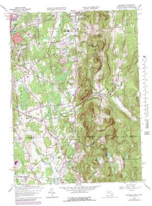
Hampden Topo Map Massachusetts
To zoom in, hover over the map of Hampden
USGS Topo Quad 42072a4 - 1:24,000 scale
| Topo Map Name: | Hampden |
| USGS Topo Quad ID: | 42072a4 |
| Print Size: | ca. 21 1/4" wide x 27" high |
| Southeast Coordinates: | 42° N latitude / 72.375° W longitude |
| Map Center Coordinates: | 42.0625° N latitude / 72.4375° W longitude |
| U.S. States: | MA, CT |
| Filename: | o42072a4.jpg |
| Download Map JPG Image: | Hampden topo map 1:24,000 scale |
| Map Type: | Topographic |
| Topo Series: | 7.5´ |
| Map Scale: | 1:24,000 |
| Source of Map Images: | United States Geological Survey (USGS) |
| Alternate Map Versions: |
Hampden MA 1946, updated 1956 Download PDF Buy paper map Hampden MA 1958, updated 1960 Download PDF Buy paper map Hampden MA 1958, updated 1968 Download PDF Buy paper map Hampden MA 1958, updated 1972 Download PDF Buy paper map Hampden MA 2012 Download PDF Buy paper map Hampden MA 2015 Download PDF Buy paper map |
1:24,000 Topo Quads surrounding Hampden
> Back to 42072a1 at 1:100,000 scale
> Back to 42072a1 at 1:250,000 scale
> Back to U.S. Topo Maps home
Hampden topo map: Gazetteer
Hampden: Airports
Mountain View Heliport elevation 82m 269′Sunny Knoll Airport elevation 77m 252′
Valley Farms Airport elevation 66m 216′
Hampden: Dams
Bennett Pond Dam elevation 68m 223′Hurds Lake Dam elevation 209m 685′
Mill Pond Dam elevation 63m 206′
Rockwell Dam elevation 108m 354′
Wenworth Farm Dam elevation 202m 662′
Hampden: Islands
Goat Rock elevation 153m 501′Hampden: Lakes
Quarry Pond elevation 68m 223′Hampden: Parks
Academy Historic District elevation 86m 282′Crane Park elevation 87m 285′
Gerrish Park elevation 96m 314′
Hampden Memorial Recreational Park elevation 134m 439′
Laughing Brook Wildlife Sanctuary elevation 94m 308′
Wilbraham Wildlife Area elevation 76m 249′
Hampden: Populated Places
Baptist Village elevation 67m 219′Hampden elevation 95m 311′
Mileoak Corner elevation 80m 262′
North Somers elevation 65m 213′
Wilbraham elevation 85m 278′
Hampden: Post Offices
Hampden Post Office elevation 94m 308′Wilbraham Post Office elevation 84m 275′
Hampden: Reservoirs
Bennett Pond elevation 68m 223′Cooley Pond elevation 199m 652′
Culver Pond elevation 202m 662′
Goodwill Pond elevation 124m 406′
Hurds Lake elevation 209m 685′
Mill Pond elevation 64m 209′
Worthington Pond elevation 178m 583′
Hampden: Streams
Avery Brook elevation 60m 196′Big Brook elevation 94m 308′
East Brook elevation 93m 305′
Gillettes Brook elevation 64m 209′
Rockadundee Brook elevation 98m 321′
Rockadundee Brook elevation 111m 364′
Schanade Brook elevation 58m 190′
Skerry Brook elevation 86m 282′
Temple Brook elevation 97m 318′
Thrasher Brook elevation 57m 187′
Thrasher Brook elevation 57m 187′
Watchaug Brook elevation 60m 196′
Watchaug Brook elevation 60m 196′
West Brook elevation 89m 291′
Hampden: Summits
Bald Mountain elevation 303m 994′Hall Hill elevation 98m 321′
Mount Chapin elevation 281m 921′
Mount Vision elevation 227m 744′
Perkins Mountain elevation 298m 977′
Pine Mountain elevation 319m 1046′
Rattlesnake Hill elevation 323m 1059′
Rattlesnake Peak elevation 239m 784′
The Pinnacle elevation 273m 895′
Wigwam Hill elevation 267m 875′
Hampden digital topo map on disk
Buy this Hampden topo map showing relief, roads, GPS coordinates and other geographical features, as a high-resolution digital map file on DVD:
New York, Vermont, Connecticut & Western Massachusetts
Buy digital topo maps: New York, Vermont, Connecticut & Western Massachusetts


