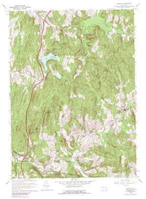
Ancram Topo Map New York
To zoom in, hover over the map of Ancram
USGS Topo Quad 42073a6 - 1:24,000 scale
| Topo Map Name: | Ancram |
| USGS Topo Quad ID: | 42073a6 |
| Print Size: | ca. 21 1/4" wide x 27" high |
| Southeast Coordinates: | 42° N latitude / 73.625° W longitude |
| Map Center Coordinates: | 42.0625° N latitude / 73.6875° W longitude |
| U.S. State: | NY |
| Filename: | o42073a6.jpg |
| Download Map JPG Image: | Ancram topo map 1:24,000 scale |
| Map Type: | Topographic |
| Topo Series: | 7.5´ |
| Map Scale: | 1:24,000 |
| Source of Map Images: | United States Geological Survey (USGS) |
| Alternate Map Versions: |
Ancram NY 1948 Download PDF Buy paper map Ancram NY 1948 Download PDF Buy paper map Ancram NY 1960, updated 1962 Download PDF Buy paper map Ancram NY 1960, updated 1969 Download PDF Buy paper map Ancram NY 1960, updated 1989 Download PDF Buy paper map Ancram NY 1960, updated 1989 Download PDF Buy paper map Ancram NY 2010 Download PDF Buy paper map Ancram NY 2013 Download PDF Buy paper map Ancram NY 2016 Download PDF Buy paper map |
1:24,000 Topo Quads surrounding Ancram
> Back to 42073a1 at 1:100,000 scale
> Back to 42072a1 at 1:250,000 scale
> Back to U.S. Topo Maps home
Ancram topo map: Gazetteer
Ancram: Lakes
Lake Taghkanic elevation 199m 652′Ancram: Parks
Lake Taghkanic State Park elevation 200m 656′Roeliff Jansen Kill State Multiple Use Area elevation 149m 488′
Ancram: Populated Places
Ancram elevation 158m 518′Gallatinville elevation 137m 449′
Jackson Corners elevation 110m 360′
Mount Ross elevation 108m 354′
New Forge elevation 152m 498′
Silvernails elevation 149m 488′
Spaulding Furnace elevation 153m 501′
West Taghkanic elevation 96m 314′
Ancram: Reservoirs
Pond Lily Pond elevation 234m 767′Ancram: Streams
Chrysler Pond Outlet elevation 161m 528′Fall Kill elevation 88m 288′
Ham Brook elevation 100m 328′
Shekomeko Creek elevation 107m 351′
Snydam Creek elevation 144m 472′
Ancram: Summits
Green Hill elevation 335m 1099′Signal Rock elevation 335m 1099′
Snake Hill elevation 219m 718′
Tiffany Hill elevation 299m 980′
Ancram digital topo map on disk
Buy this Ancram topo map showing relief, roads, GPS coordinates and other geographical features, as a high-resolution digital map file on DVD:
New York, Vermont, Connecticut & Western Massachusetts
Buy digital topo maps: New York, Vermont, Connecticut & Western Massachusetts


