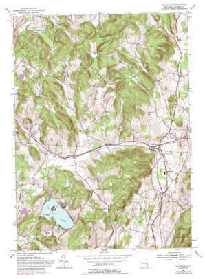
Hillsdale Topo Map New York
To zoom in, hover over the map of Hillsdale
USGS Topo Quad 42073b5 - 1:24,000 scale
| Topo Map Name: | Hillsdale |
| USGS Topo Quad ID: | 42073b5 |
| Print Size: | ca. 21 1/4" wide x 27" high |
| Southeast Coordinates: | 42.125° N latitude / 73.5° W longitude |
| Map Center Coordinates: | 42.1875° N latitude / 73.5625° W longitude |
| U.S. State: | NY |
| Filename: | o42073b5.jpg |
| Download Map JPG Image: | Hillsdale topo map 1:24,000 scale |
| Map Type: | Topographic |
| Topo Series: | 7.5´ |
| Map Scale: | 1:24,000 |
| Source of Map Images: | United States Geological Survey (USGS) |
| Alternate Map Versions: |
Hillsdale NY 1953, updated 1955 Download PDF Buy paper map Hillsdale NY 1953, updated 1965 Download PDF Buy paper map Hillsdale NY 1953, updated 1988 Download PDF Buy paper map Hillsdale NY 1980, updated 1981 Download PDF Buy paper map Hillsdale NY 2010 Download PDF Buy paper map Hillsdale NY 2013 Download PDF Buy paper map Hillsdale NY 2016 Download PDF Buy paper map |
1:24,000 Topo Quads surrounding Hillsdale
> Back to 42073a1 at 1:100,000 scale
> Back to 42072a1 at 1:250,000 scale
> Back to U.S. Topo Maps home
Hillsdale topo map: Gazetteer
Hillsdale: Airports
Copake Lake Seaplane Base elevation 218m 715′Hillsdale: Bridges
Black Grocery Bridge elevation 179m 587′Hillsdale: Islands
Mosquito Island elevation 219m 718′Hillsdale: Lakes
Copake Lake elevation 218m 715′Goose Pond elevation 166m 544′
Hillsdale: Populated Places
Copake Lake elevation 219m 718′Craryville elevation 194m 636′
East Hillsdale elevation 222m 728′
Hillsdale elevation 216m 708′
North Hillsdale elevation 248m 813′
Pumpkin Hollow elevation 177m 580′
Hillsdale: Reservoirs
Philmont Reservoir elevation 211m 692′Hillsdale: Summits
Bloody Hill elevation 262m 859′Center Hill elevation 334m 1095′
Lyon Mountain elevation 426m 1397′
Pond Hill elevation 204m 669′
Pumpkin Hollow elevation 374m 1227′
Rheinstrom Hill elevation 377m 1236′
Scutt Hill elevation 371m 1217′
Texas Hill elevation 362m 1187′
Hillsdale: Valleys
Knapp Hollow elevation 203m 666′Shepard Hollow elevation 300m 984′
Hillsdale digital topo map on disk
Buy this Hillsdale topo map showing relief, roads, GPS coordinates and other geographical features, as a high-resolution digital map file on DVD:
New York, Vermont, Connecticut & Western Massachusetts
Buy digital topo maps: New York, Vermont, Connecticut & Western Massachusetts


