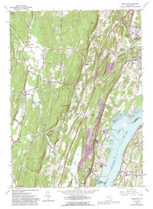
Cementon Topo Map New York
To zoom in, hover over the map of Cementon
USGS Topo Quad 42073b8 - 1:24,000 scale
| Topo Map Name: | Cementon |
| USGS Topo Quad ID: | 42073b8 |
| Print Size: | ca. 21 1/4" wide x 27" high |
| Southeast Coordinates: | 42.125° N latitude / 73.875° W longitude |
| Map Center Coordinates: | 42.1875° N latitude / 73.9375° W longitude |
| U.S. State: | NY |
| Filename: | o42073b8.jpg |
| Download Map JPG Image: | Cementon topo map 1:24,000 scale |
| Map Type: | Topographic |
| Topo Series: | 7.5´ |
| Map Scale: | 1:24,000 |
| Source of Map Images: | United States Geological Survey (USGS) |
| Alternate Map Versions: |
Cementon NY 1963, updated 1965 Download PDF Buy paper map Cementon NY 1963, updated 1971 Download PDF Buy paper map Cementon NY 1963, updated 1981 Download PDF Buy paper map Cementon NY 1963, updated 1988 Download PDF Buy paper map Cementon NY 2010 Download PDF Buy paper map Cementon NY 2013 Download PDF Buy paper map Cementon NY 2016 Download PDF Buy paper map |
1:24,000 Topo Quads surrounding Cementon
> Back to 42073a1 at 1:100,000 scale
> Back to 42072a1 at 1:250,000 scale
> Back to U.S. Topo Maps home
Cementon topo map: Gazetteer
Cementon: Bays
Duck Cove elevation 0m 0′Inbocht Bay elevation 0m 0′
Cementon: Capes
Dewitt Point elevation 13m 42′Silver Point elevation 6m 19′
Cementon: Channels
North German Town Reach elevation 0m 0′Cementon: Crossings
Interchange 21 elevation 65m 213′Cementon: Flats
Kiskatom Flats elevation 105m 344′Cementon: Islands
Wanton Island elevation 0m 0′Cementon: Lakes
Van Luven Lake elevation 67m 219′Cementon: Populated Places
Alsen elevation 37m 121′Asbury elevation 51m 167′
Cauterskill elevation 11m 36′
Cementon elevation 29m 95′
Cheviot elevation 10m 32′
Germantown elevation 41m 134′
High Falls elevation 68m 223′
Jefferson Heights elevation 54m 177′
Kiskatom elevation 96m 314′
Kiskaton Mobile Home Park elevation 94m 308′
Lawrenceville elevation 118m 387′
North Germantown elevation 53m 173′
Saxton elevation 117m 383′
Smith Landing elevation 2m 6′
Cementon: Ridges
Bethel Ridge elevation 158m 518′Kalkberg elevation 101m 331′
Cementon: Streams
Beaver Kill elevation 30m 98′Kaaterskill Creek elevation 7m 22′
Kiskatom Brook elevation 102m 334′
Mineral Spring Brook elevation 2m 6′
Post Creek elevation 0m 0′
Rocky Branch elevation 68m 223′
Stony Brook elevation 106m 347′
Vly Creek elevation 107m 351′
Cementon: Summits
Quarry Hill elevation 95m 311′Timmerman Hill elevation 181m 593′
Vedder Mountain elevation 192m 629′
Cementon: Swamps
Great Vly elevation 46m 150′Cementon: Valleys
Austin Glen elevation 47m 154′Cementon digital topo map on disk
Buy this Cementon topo map showing relief, roads, GPS coordinates and other geographical features, as a high-resolution digital map file on DVD:
New York, Vermont, Connecticut & Western Massachusetts
Buy digital topo maps: New York, Vermont, Connecticut & Western Massachusetts


