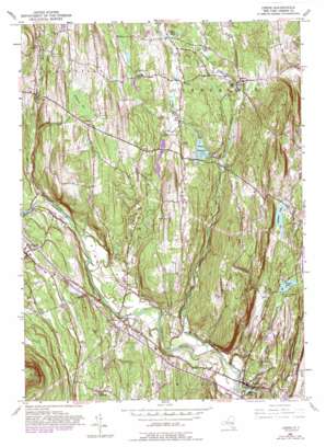
Leeds Topo Map New York
To zoom in, hover over the map of Leeds
USGS Topo Quad 42073c8 - 1:24,000 scale
| Topo Map Name: | Leeds |
| USGS Topo Quad ID: | 42073c8 |
| Print Size: | ca. 21 1/4" wide x 27" high |
| Southeast Coordinates: | 42.25° N latitude / 73.875° W longitude |
| Map Center Coordinates: | 42.3125° N latitude / 73.9375° W longitude |
| U.S. State: | NY |
| Filename: | o42073c8.jpg |
| Download Map JPG Image: | Leeds topo map 1:24,000 scale |
| Map Type: | Topographic |
| Topo Series: | 7.5´ |
| Map Scale: | 1:24,000 |
| Source of Map Images: | United States Geological Survey (USGS) |
| Alternate Map Versions: |
Leeds NY 1953, updated 1955 Download PDF Buy paper map Leeds NY 1953, updated 1964 Download PDF Buy paper map Leeds NY 1953, updated 1981 Download PDF Buy paper map Leeds NY 1953, updated 1989 Download PDF Buy paper map Leeds NY 2010 Download PDF Buy paper map Leeds NY 2013 Download PDF Buy paper map Leeds NY 2016 Download PDF Buy paper map |
1:24,000 Topo Quads surrounding Leeds
> Back to 42073a1 at 1:100,000 scale
> Back to 42072a1 at 1:250,000 scale
> Back to U.S. Topo Maps home
Leeds topo map: Gazetteer
Leeds: Airports
Catskill Valley Airpark elevation 56m 183′Leeds: Bridges
Lakes Mills Bridge elevation 70m 229′Three Town Bridge elevation 111m 364′
Leeds: Flats
Leeds Flat elevation 45m 147′Sandy Plain elevation 76m 249′
Leeds: Lakes
Canoe Lake elevation 63m 206′Dots Lake elevation 146m 479′
Greens Lake elevation 77m 252′
Hollister Lake elevation 93m 305′
Mill Pond elevation 123m 403′
Mill Pond elevation 30m 98′
Leeds: Populated Places
Cairo elevation 114m 374′Cairo Junction elevation 104m 341′
Earlton elevation 127m 416′
Feddes Mobile Home Park elevation 51m 167′
Gayhead elevation 221m 725′
Leeds elevation 48m 157′
Limestreet elevation 77m 252′
Place Corners elevation 190m 623′
Result elevation 188m 616′
South Cairo elevation 61m 200′
Leeds: Reservoirs
Potuck Reservoir elevation 131m 429′Leeds: Ridges
Indian Ridge elevation 185m 606′Leeds: Streams
Bell Brook elevation 54m 177′Cob Creek elevation 113m 370′
Grapeville Creek elevation 120m 393′
Jan De Bakkers Kill elevation 70m 229′
Potic Creek elevation 39m 127′
Shingle Kill elevation 82m 269′
West Medway Creek elevation 139m 456′
Leeds: Summits
Cairo Round Top elevation 437m 1433′Potic Mountain elevation 180m 590′
Leeds: Swamps
Gayhead Vly elevation 209m 685′Leeds digital topo map on disk
Buy this Leeds topo map showing relief, roads, GPS coordinates and other geographical features, as a high-resolution digital map file on DVD:
New York, Vermont, Connecticut & Western Massachusetts
Buy digital topo maps: New York, Vermont, Connecticut & Western Massachusetts


