East Chatham Topo Map New York
To zoom in, hover over the map of East Chatham
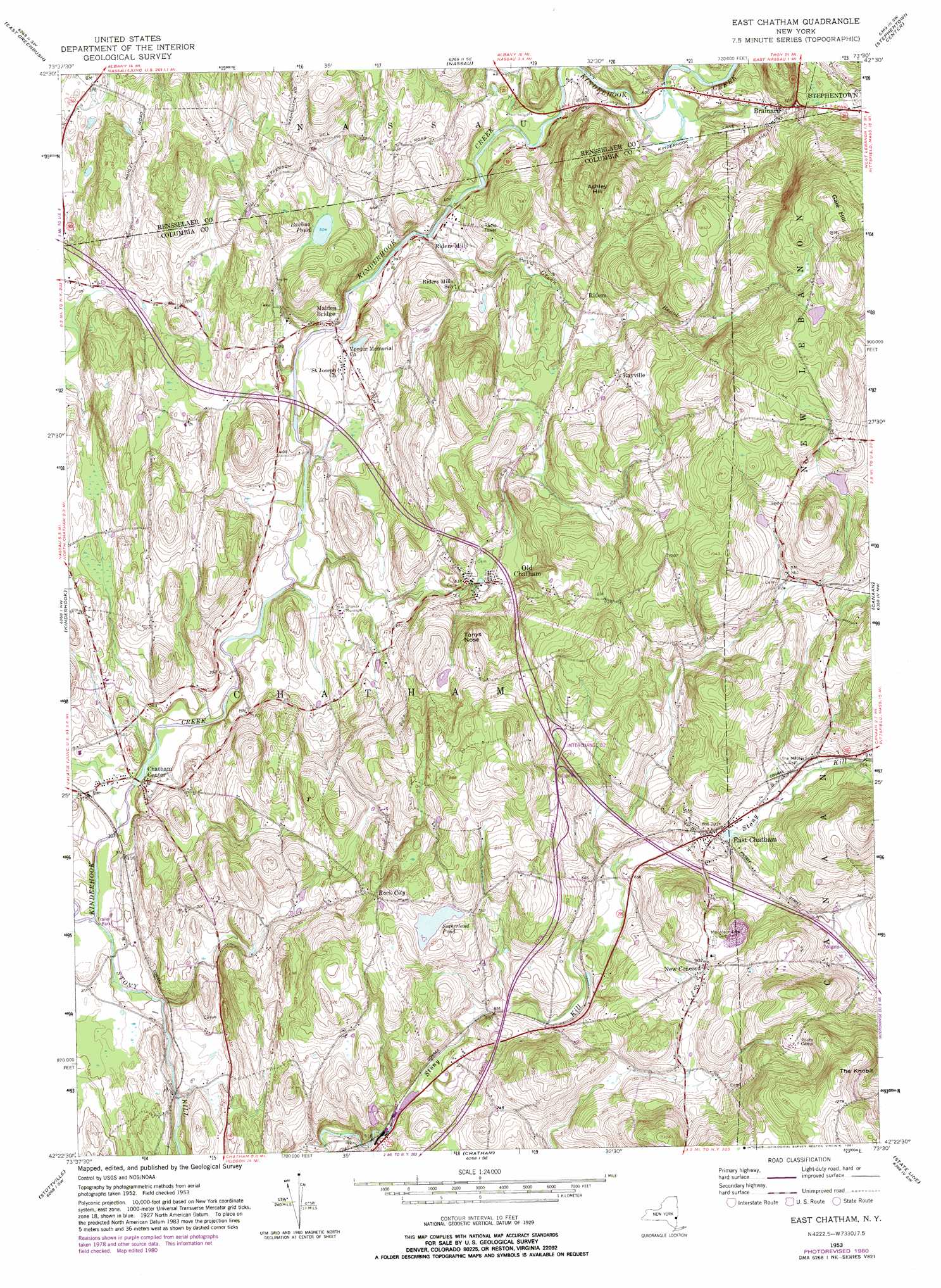
USGS Topo Quad 42073d5 - 1:24,000 scale
| Topo Map Name: | East Chatham |
| USGS Topo Quad ID: | 42073d5 |
| Print Size: | ca. 21 1/4" wide x 27" high |
| Southeast Coordinates: | 42.375° N latitude / 73.5° W longitude |
| Map Center Coordinates: | 42.4375° N latitude / 73.5625° W longitude |
| U.S. State: | NY |
| Filename: | o42073d5.jpg |
| Download Map JPG Image: | East Chatham topo map 1:24,000 scale |
| Map Type: | Topographic |
| Topo Series: | 7.5´ |
| Map Scale: | 1:24,000 |
| Source of Map Images: | United States Geological Survey (USGS) |
| Alternate Map Versions: |
East Chatham NY 1953, updated 1955 Download PDF Buy paper map East Chatham NY 1953, updated 1968 Download PDF Buy paper map East Chatham NY 1953, updated 1981 Download PDF Buy paper map East Chatham NY 2010 Download PDF Buy paper map East Chatham NY 2013 Download PDF Buy paper map East Chatham NY 2016 Download PDF Buy paper map |
1:24,000 Topo Quads surrounding East Chatham
Albany |
Troy South |
Averill Park |
Berlin |
|
Delmar |
East Greenbush |
Nassau |
Hancock |
|
Ravena |
Kinderhook |
East Chatham |
Pittsfield West |
|
Hudson North |
Stottville |
Chatham |
Stockbridge |
|
Hudson South |
Claverack |
Hillsdale |
Great Barrington |
> Back to 42073a1 at 1:100,000 scale
> Back to 42072a1 at 1:250,000 scale
> Back to U.S. Topo Maps home
East Chatham topo map: Gazetteer
East Chatham: Airports
TGP-254 Heliport elevation 128m 419′East Chatham: Lakes
Bachus Pond elevation 153m 501′Sutherland Pond elevation 231m 757′
East Chatham: Populated Places
Brainard elevation 207m 679′Breezy Hills Mobile Home Park elevation 172m 564′
Chatham Center elevation 90m 295′
East Chatham elevation 214m 702′
Golden Acres elevation 89m 291′
Malden Bridge elevation 118m 387′
New Concord elevation 254m 833′
Old Chatham elevation 163m 534′
Rayville elevation 226m 741′
Riders elevation 195m 639′
Riders Mills elevation 125m 410′
Rock City elevation 222m 728′
East Chatham: Streams
Frisbee Creek elevation 198m 649′Green Brook elevation 122m 400′
Stony Kill elevation 82m 269′
East Chatham: Summits
Ashley Hill elevation 280m 918′Gale Hill elevation 352m 1154′
The Knobit elevation 411m 1348′
Tonys Nose elevation 209m 685′
East Chatham digital topo map on disk
Buy this East Chatham topo map showing relief, roads, GPS coordinates and other geographical features, as a high-resolution digital map file on DVD:
New York, Vermont, Connecticut & Western Massachusetts
Buy digital topo maps: New York, Vermont, Connecticut & Western Massachusetts