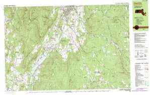
Windsor Topo Map Massachusetts
To zoom in, hover over the map of Windsor
USGS Topo Quad 42073e1 - 1:25,000 scale
| Topo Map Name: | Windsor |
| USGS Topo Quad ID: | 42073e1 |
| Print Size: | ca. 39" wide x 24" high |
| Southeast Coordinates: | 42.5° N latitude / 73° W longitude |
| Map Center Coordinates: | 42.5625° N latitude / 73.125° W longitude |
| U.S. State: | MA |
| Filename: | k42073e1.jpg |
| Download Map JPG Image: | Windsor topo map 1:25,000 scale |
| Map Type: | Topographic |
| Topo Series: | 7.5´x15´ |
| Map Scale: | 1:25,000 |
| Source of Map Images: | United States Geological Survey (USGS) |
| Alternate Map Versions: |
Cheshire MA 1988, updated 1988 Download PDF Buy paper map Cheshire MA 1988, updated 1988 Download PDF Buy paper map Cheshire MA 1998, updated 2000 Download PDF Buy paper map |
1:24,000 Topo Quads surrounding Windsor
North Pownal |
Pownal |
Stamford |
Readsboro |
Jacksonville |
Berlin |
North Adams |
Heath |
||
Hancock |
Windsor |
Ashfield |
||
Pittsfield West |
Peru |
Goshen |
||
Stockbridge |
Becket |
Westhampton |
> Back to 42073e1 at 1:100,000 scale
> Back to 42072a1 at 1:250,000 scale
> Back to U.S. Topo Maps home
Windsor topo map: Gazetteer
Windsor: Airports
Air Hill Farms Landing Strip elevation 384m 1259′Kendalls Landing Area elevation 642m 2106′
Windsor: Cliffs
Jones Nose elevation 779m 2555′Windsor: Dams
Bassett Reservoir Dam elevation 330m 1082′Burnett Pond elevation 596m 1955′
Cheshire Reservoir Dam elevation 296m 971′
Windsor: Falls
Tannery Falls elevation 420m 1377′Windsor: Forests
Savoy Mountain State Forest elevation 736m 2414′Windsor State Forest elevation 572m 1876′
Windsor: Islands
Cheshire Cemetery elevation 354m 1161′Windsor: Lakes
Anthony Pond elevation 555m 1820′Berkshire Pond elevation 301m 987′
Dean Pond (historical) elevation 305m 1000′
Gore Pond elevation 616m 2020′
Windsor: Parks
Mount Greylock State Reservation elevation 939m 3080′Pioneer Monument elevation 483m 1584′
Rusek Whipple Square elevation 252m 826′
Stafford Hill Wildlife Management Area elevation 480m 1574′
Stafford Hill Wildlife Management Area elevation 305m 1000′
Summer Street Historic District elevation 257m 843′
Windsor James State Park elevation 432m 1417′
Windsor: Populated Places
Adams elevation 242m 793′Arnoldville elevation 352m 1154′
Berkshire elevation 307m 1007′
Bowens Corners elevation 339m 1112′
Camp Mohawk elevation 322m 1056′
Cheshire elevation 301m 987′
Cheshire Harbor elevation 285m 935′
Farnams elevation 328m 1076′
Greylock Estates elevation 364m 1194′
Lanesborough elevation 344m 1128′
Little Egypt elevation 494m 1620′
Maple Grove elevation 270m 885′
New Ashford elevation 388m 1272′
Savoy elevation 527m 1729′
Savoy Center elevation 647m 2122′
Town Crest Village elevation 308m 1010′
Windsor elevation 622m 2040′
Windsor: Post Offices
Berkshire Post Office elevation 311m 1020′Cheshire Post Office elevation 295m 967′
Lanesboro Post Office elevation 354m 1161′
Windsor Post Office (historical) elevation 621m 2037′
Windsor: Reservoirs
Bassett Reservoir elevation 330m 1082′Burnett Pond elevation 596m 1955′
Cheshire Reservoir elevation 296m 971′
Windsor: Streams
Baker Brook elevation 466m 1528′Bassett Brook elevation 284m 931′
Center Brook elevation 528m 1732′
Collins Brook elevation 296m 971′
Drowned Land Brook elevation 528m 1732′
Dry Brook elevation 270m 885′
Gore Brook elevation 297m 974′
Hoxie Brook elevation 240m 787′
Kitchen Brook elevation 294m 964′
McDonald Brook elevation 343m 1125′
Mitchell Brook elevation 338m 1108′
Muddy Brook elevation 297m 974′
Parker Brook elevation 465m 1525′
Patton Brook elevation 413m 1354′
Pecks Brook elevation 247m 810′
Penniman Brook elevation 403m 1322′
Pettibone Brook elevation 296m 971′
Reed Brook elevation 297m 974′
Ross Brook elevation 420m 1377′
Savoy Hollow Brook elevation 556m 1824′
South Brook elevation 293m 961′
Steep Bank Brook elevation 435m 1427′
Thunder Brook elevation 342m 1122′
Town Brook elevation 336m 1102′
Tyler Brook elevation 536m 1758′
Windsor: Summits
Borden Mountain elevation 761m 2496′Briggs Cobble elevation 350m 1148′
Cheshire Harbor Hill elevation 390m 1279′
Cole Mountain elevation 643m 2109′
Constitution Hill elevation 489m 1604′
Farnams Hill elevation 487m 1597′
Fobes Hill elevation 644m 2112′
Hales Hill elevation 428m 1404′
Judges Hill elevation 702m 2303′
Lewis Hill elevation 655m 2148′
Mount Amos elevation 459m 1505′
North Mountain elevation 665m 2181′
Pratt Hill elevation 553m 1814′
Rounds Rock elevation 782m 2565′
Saddle Ball Mountain elevation 985m 3231′
Savage Hill elevation 582m 1909′
Stafford Hill elevation 496m 1627′
Sugarloaf elevation 600m 1968′
The Cobbles elevation 561m 1840′
The Noppet elevation 538m 1765′
The Pinnacle elevation 386m 1266′
Weston Mountain elevation 685m 2247′
Windsor Hill elevation 591m 1938′
Woodchuck Hill elevation 661m 2168′
Windsor: Trails
Cheshire Harbor Trail elevation 682m 2237′Windsor digital topo map on disk
Buy this Windsor topo map showing relief, roads, GPS coordinates and other geographical features, as a high-resolution digital map file on DVD:
New York, Vermont, Connecticut & Western Massachusetts
Buy digital topo maps: New York, Vermont, Connecticut & Western Massachusetts


