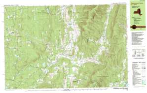
Hancock Topo Map Massachusetts
To zoom in, hover over the map of Hancock
USGS Topo Quad 42073e3 - 1:25,000 scale
| Topo Map Name: | Hancock |
| USGS Topo Quad ID: | 42073e3 |
| Print Size: | ca. 39" wide x 24" high |
| Southeast Coordinates: | 42.5° N latitude / 73.25° W longitude |
| Map Center Coordinates: | 42.5625° N latitude / 73.375° W longitude |
| U.S. States: | MA, NY |
| Filename: | k42073e3.jpg |
| Download Map JPG Image: | Hancock topo map 1:25,000 scale |
| Map Type: | Topographic |
| Topo Series: | 7.5´x15´ |
| Map Scale: | 1:25,000 |
| Source of Map Images: | United States Geological Survey (USGS) |
| Alternate Map Versions: |
Stephentown Center MA 1988, updated 1988 Download PDF Buy paper map Stephentown Center MA 1998, updated 2000 Download PDF Buy paper map |
1:24,000 Topo Quads surrounding Hancock
Tomhannock |
Grafton |
North Pownal |
Pownal |
Stamford |
Averill Park |
Berlin |
North Adams |
||
Nassau |
Hancock |
Windsor |
||
East Chatham |
Pittsfield West |
Peru |
||
Chatham |
Stockbridge |
Becket |
> Back to 42073e1 at 1:100,000 scale
> Back to 42072a1 at 1:250,000 scale
> Back to U.S. Topo Maps home
Hancock topo map: Gazetteer
Hancock: Forests
Capital District Forest and Game Refuge elevation 505m 1656′Hancock: Lakes
Berry Pond elevation 631m 2070′Black Pond elevation 309m 1013′
Black River Pond elevation 424m 1391′
Douglas Pond elevation 335m 1099′
Griswold Pond elevation 285m 935′
Stone Bridge Pond elevation 425m 1394′
Stump Pond elevation 440m 1443′
Taplin Pond elevation 296m 971′
Hancock: Parks
Balance Rock State Park elevation 379m 1243′Forbush Wildlife Sanctuary elevation 535m 1755′
Hancock: Pillars
Eagle Rock elevation 449m 1473′Hancock: Populated Places
Chuckleberry Mobile Home Park elevation 331m 1085′Dunham Hollow elevation 317m 1040′
Garfield elevation 253m 830′
Hancock elevation 309m 1013′
North Hancock elevation 367m 1204′
North Stephentown elevation 339m 1112′
Stephentown elevation 267m 875′
Stephentown Center elevation 345m 1131′
West Stephentown elevation 388m 1272′
Wyomanock elevation 284m 931′
Hancock: Post Offices
Hancock Post Office elevation 307m 1007′Hancock: Ranges
Taconic Range elevation 679m 2227′Hancock: Ridges
Pease Ridge elevation 562m 1843′Hancock: Streams
Bentley Brook elevation 341m 1118′Berry Pond Creek elevation 270m 885′
Berry Pond Creek elevation 270m 885′
Black River elevation 246m 807′
East Brook elevation 264m 866′
Hollow Brook elevation 349m 1145′
Huff Brook elevation 308m 1010′
Jones Brook elevation 358m 1174′
Rathburn Brook elevation 377m 1236′
Red Oak Brook elevation 408m 1338′
Roaring Brook elevation 244m 800′
Rocky Brook elevation 318m 1043′
Secum Brook elevation 333m 1092′
Taplin Bourn elevation 237m 777′
West Brook elevation 264m 866′
Whitman Brook elevation 342m 1122′
Hancock: Summits
Appletree Hill elevation 539m 1768′Bald Hill elevation 367m 1204′
Beoadic Mountain elevation 792m 2598′
Berry Hill elevation 666m 2185′
Berry Mountain elevation 668m 2191′
Buckwheat Hill elevation 529m 1735′
Butternut Hill elevation 505m 1656′
East Mountain elevation 791m 2595′
Honwee Mountain elevation 698m 2290′
Jiminy Peak elevation 726m 2381′
Johnson Hill elevation 537m 1761′
Laurel Hill elevation 494m 1620′
Misery Mountain elevation 662m 2171′
Misery Mountain elevation 793m 2601′
Moore Hill elevation 508m 1666′
Pomeroy Hill elevation 451m 1479′
Potter Mountain elevation 678m 2224′
Roberts Hill elevation 316m 1036′
Rounds Mountain elevation 683m 2240′
Rounds Mountain elevation 685m 2247′
Sheeps Heaven Mountain elevation 770m 2526′
The Pinnacle elevation 525m 1722′
Turner Mountain elevation 506m 1660′
Widow Whites Peak elevation 737m 2417′
Hancock: Swamps
Sabarney Gile Swamp elevation 243m 797′Squaw Swamp elevation 297m 974′
Hancock: Valleys
Bentley Hollow elevation 353m 1158′Doty Hollow elevation 285m 935′
Doty Hollow elevation 288m 944′
Gardner Hollow elevation 400m 1312′
Goodrich Hollow elevation 360m 1181′
Goodrich Hollow elevation 283m 928′
Robinson Hollow elevation 357m 1171′
Hancock digital topo map on disk
Buy this Hancock topo map showing relief, roads, GPS coordinates and other geographical features, as a high-resolution digital map file on DVD:
New York, Vermont, Connecticut & Western Massachusetts
Buy digital topo maps: New York, Vermont, Connecticut & Western Massachusetts


