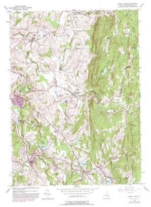
Averill Park Topo Map New York
To zoom in, hover over the map of Averill Park
USGS Topo Quad 42073f5 - 1:24,000 scale
| Topo Map Name: | Averill Park |
| USGS Topo Quad ID: | 42073f5 |
| Print Size: | ca. 21 1/4" wide x 27" high |
| Southeast Coordinates: | 42.625° N latitude / 73.5° W longitude |
| Map Center Coordinates: | 42.6875° N latitude / 73.5625° W longitude |
| U.S. State: | NY |
| Filename: | o42073f5.jpg |
| Download Map JPG Image: | Averill Park topo map 1:24,000 scale |
| Map Type: | Topographic |
| Topo Series: | 7.5´ |
| Map Scale: | 1:24,000 |
| Source of Map Images: | United States Geological Survey (USGS) |
| Alternate Map Versions: |
Averill Park NY 1953, updated 1955 Download PDF Buy paper map Averill Park NY 1953, updated 1964 Download PDF Buy paper map Averill Park NY 1953, updated 1973 Download PDF Buy paper map Averill Park NY 1953, updated 1981 Download PDF Buy paper map Averill Park NY 2010 Download PDF Buy paper map Averill Park NY 2013 Download PDF Buy paper map Averill Park NY 2016 Download PDF Buy paper map |
1:24,000 Topo Quads surrounding Averill Park
> Back to 42073e1 at 1:100,000 scale
> Back to 42072a1 at 1:250,000 scale
> Back to U.S. Topo Maps home
Averill Park topo map: Gazetteer
Averill Park: Airports
Rensselaer County Airport elevation 134m 439′Averill Park: Cliffs
Crystal Cliff elevation 196m 643′Averill Park: Lakes
Bernie Pond elevation 352m 1154′Coopers Pond elevation 142m 465′
Crystal Lake elevation 235m 770′
Davitt Pond elevation 380m 1246′
Links Pond elevation 182m 597′
Moules Lake elevation 148m 485′
Racquet Lake elevation 179m 587′
Vosburg Pond elevation 195m 639′
Averill Park: Populated Places
Averill Park elevation 239m 784′Barberville elevation 244m 800′
Bon Acre elevation 195m 639′
Brunswick elevation 158m 518′
Cropseyville elevation 170m 557′
Eagle Mills elevation 127m 416′
Glass Lake elevation 256m 839′
Ives Corner elevation 283m 928′
Poestenkill elevation 146m 479′
Sand Lake elevation 238m 780′
Snyders Corner elevation 135m 442′
West Sand Lake elevation 160m 524′
Averill Park: Streams
Bonesteel Creek elevation 256m 839′Horse Heaven Brook elevation 235m 770′
Newfoundland Creek elevation 129m 423′
Quacken Kill elevation 128m 419′
Averill Park: Summits
Bare Top Mountain elevation 401m 1315′Smauder Hill elevation 251m 823′
Snake Hill elevation 373m 1223′
Averill Park digital topo map on disk
Buy this Averill Park topo map showing relief, roads, GPS coordinates and other geographical features, as a high-resolution digital map file on DVD:
New York, Vermont, Connecticut & Western Massachusetts
Buy digital topo maps: New York, Vermont, Connecticut & Western Massachusetts


