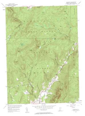
Stamford Topo Map Vermont
To zoom in, hover over the map of Stamford
USGS Topo Quad 42073g1 - 1:24,000 scale
| Topo Map Name: | Stamford |
| USGS Topo Quad ID: | 42073g1 |
| Print Size: | ca. 21 1/4" wide x 27" high |
| Southeast Coordinates: | 42.75° N latitude / 73° W longitude |
| Map Center Coordinates: | 42.8125° N latitude / 73.0625° W longitude |
| U.S. State: | VT |
| Filename: | o42073g1.jpg |
| Download Map JPG Image: | Stamford topo map 1:24,000 scale |
| Map Type: | Topographic |
| Topo Series: | 7.5´ |
| Map Scale: | 1:24,000 |
| Source of Map Images: | United States Geological Survey (USGS) |
| Alternate Map Versions: |
Stamford VT 1954, updated 1957 Download PDF Buy paper map Stamford VT 1954, updated 1962 Download PDF Buy paper map Stamford VT 1954, updated 1984 Download PDF Buy paper map Stamford VT 1997, updated 2000 Download PDF Buy paper map Stamford VT 2012 Download PDF Buy paper map Stamford VT 2015 Download PDF Buy paper map |
| FStopo: | US Forest Service topo Stamford is available: Download FStopo PDF Download FStopo TIF |
1:24,000 Topo Quads surrounding Stamford
> Back to 42073e1 at 1:100,000 scale
> Back to 42072a1 at 1:250,000 scale
> Back to U.S. Topo Maps home
Stamford topo map: Gazetteer
Stamford: Lakes
Mud Pond elevation 681m 2234′Stamford Pond elevation 721m 2365′
Yaw Pond elevation 612m 2007′
Stamford: Parks
Stamford Meadows Wildlife Management Area elevation 799m 2621′Stamford: Populated Places
Stamford elevation 344m 1128′Village of Alpenwald elevation 761m 2496′
Stamford: Streams
Basin Brook elevation 379m 1243′Brown Brook elevation 335m 1099′
Cardinal Brook elevation 510m 1673′
Crazy John Stream elevation 416m 1364′
Fuller Brook elevation 352m 1154′
Goodrich Brook elevation 342m 1122′
Harris Brook elevation 341m 1118′
Nunge Brook elevation 593m 1945′
Reservoir Brook elevation 616m 2020′
Roaring Brook elevation 334m 1095′
Sumner Brook elevation 363m 1190′
Yaw Pond Brook elevation 579m 1899′
Stamford: Summits
Allen Hill elevation 738m 2421′Bare Hill elevation 691m 2267′
Dutch Hill elevation 803m 2634′
Houghton Mountain elevation 940m 3083′
Prospect Mountain elevation 842m 2762′
Scrub Hill elevation 885m 2903′
Spruce Hill elevation 860m 2821′
Stamford and Woodford Plateau elevation 780m 2559′
Stamford: Swamps
Beaver Meadows elevation 698m 2290′Camp Meadows elevation 704m 2309′
Stamford Meadows elevation 722m 2368′
Stamford: Trails
Kelly Camp Trail elevation 645m 2116′Old Stage Trail elevation 744m 2440′
Stamford digital topo map on disk
Buy this Stamford topo map showing relief, roads, GPS coordinates and other geographical features, as a high-resolution digital map file on DVD:
New York, Vermont, Connecticut & Western Massachusetts
Buy digital topo maps: New York, Vermont, Connecticut & Western Massachusetts


