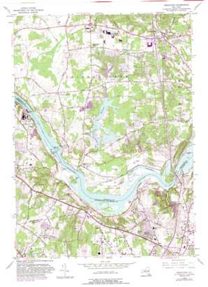
Niskayuna Topo Map New York
To zoom in, hover over the map of Niskayuna
USGS Topo Quad 42073g7 - 1:24,000 scale
| Topo Map Name: | Niskayuna |
| USGS Topo Quad ID: | 42073g7 |
| Print Size: | ca. 21 1/4" wide x 27" high |
| Southeast Coordinates: | 42.75° N latitude / 73.75° W longitude |
| Map Center Coordinates: | 42.8125° N latitude / 73.8125° W longitude |
| U.S. State: | NY |
| Filename: | o42073g7.jpg |
| Download Map JPG Image: | Niskayuna topo map 1:24,000 scale |
| Map Type: | Topographic |
| Topo Series: | 7.5´ |
| Map Scale: | 1:24,000 |
| Source of Map Images: | United States Geological Survey (USGS) |
| Alternate Map Versions: |
Niskayuna NY 1954, updated 1956 Download PDF Buy paper map Niskayuna NY 1954, updated 1965 Download PDF Buy paper map Niskayuna NY 1954, updated 1981 Download PDF Buy paper map Niskayuna NY 1954, updated 1988 Download PDF Buy paper map Niskayuna NY 2010 Download PDF Buy paper map Niskayuna NY 2013 Download PDF Buy paper map Niskayuna NY 2016 Download PDF Buy paper map |
1:24,000 Topo Quads surrounding Niskayuna
> Back to 42073e1 at 1:100,000 scale
> Back to 42072a1 at 1:250,000 scale
> Back to U.S. Topo Maps home
Niskayuna topo map: Gazetteer
Niskayuna: Airports
General Electric Research and Development Center Heliport elevation 108m 354′Niskayuna: Bridges
Thaddeus Kosciusko Bridge elevation 56m 183′Niskayuna: Crossings
Interchange Number Eight elevation 92m 301′Interchange Number Nine elevation 101m 331′
Interchange Number Six elevation 95m 311′
Niskayuna: Dams
Lock Number 7 elevation 64m 209′Niskayuna: Islands
Goat Island elevation 60m 196′Niska Island elevation 61m 200′
Niskayuna: Parks
Burns Whitney Park elevation 81m 265′Lishakill Park elevation 86m 282′
New York State Game Management Area elevation 54m 177′
Niskayuna: Populated Places
Central Square Mobile Home Park elevation 92m 301′Clifton Park elevation 105m 344′
Clifton Park Center elevation 98m 321′
Dunsbach Ferry elevation 57m 187′
Flagler Corners elevation 91m 298′
Grays Corners elevation 84m 275′
Groom Corners elevation 104m 341′
Halfmoon Beach elevation 59m 193′
Lisha Kill elevation 92m 301′
Martindale Mobile Home Park elevation 111m 364′
Mohawk View elevation 65m 213′
Niskayuna elevation 89m 291′
Springbrook Mobile Home Park elevation 82m 269′
Verdoy elevation 86m 282′
Vischer Ferry elevation 65m 213′
Whitney Estates elevation 87m 285′
Niskayuna: Reservoirs
Colonie Reservoir elevation 79m 259′Niskayuna: Streams
Delphus Kill elevation 61m 200′Lisha Kill elevation 58m 190′
Shakers Creek elevation 61m 200′
Stony Creek elevation 56m 183′
Niskayuna digital topo map on disk
Buy this Niskayuna topo map showing relief, roads, GPS coordinates and other geographical features, as a high-resolution digital map file on DVD:
New York, Vermont, Connecticut & Western Massachusetts
Buy digital topo maps: New York, Vermont, Connecticut & Western Massachusetts


