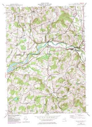
Eagle Bridge Topo Map New York
To zoom in, hover over the map of Eagle Bridge
USGS Topo Quad 42073h4 - 1:24,000 scale
| Topo Map Name: | Eagle Bridge |
| USGS Topo Quad ID: | 42073h4 |
| Print Size: | ca. 21 1/4" wide x 27" high |
| Southeast Coordinates: | 42.875° N latitude / 73.375° W longitude |
| Map Center Coordinates: | 42.9375° N latitude / 73.4375° W longitude |
| U.S. State: | NY |
| Filename: | o42073h4.jpg |
| Download Map JPG Image: | Eagle Bridge topo map 1:24,000 scale |
| Map Type: | Topographic |
| Topo Series: | 7.5´ |
| Map Scale: | 1:24,000 |
| Source of Map Images: | United States Geological Survey (USGS) |
| Alternate Map Versions: |
Eagle Bridge NY 1944, updated 1958 Download PDF Buy paper map Eagle Bridge NY 1944, updated 1966 Download PDF Buy paper map Eagle Bridge NY 1944, updated 1981 Download PDF Buy paper map Eagle Bridge NY 2010 Download PDF Buy paper map Eagle Bridge NY 2013 Download PDF Buy paper map Eagle Bridge NY 2016 Download PDF Buy paper map |
1:24,000 Topo Quads surrounding Eagle Bridge
> Back to 42073e1 at 1:100,000 scale
> Back to 42072a1 at 1:250,000 scale
> Back to U.S. Topo Maps home
Eagle Bridge topo map: Gazetteer
Eagle Bridge: Airports
Moseleys Airport elevation 157m 515′Eagle Bridge: Bridges
Buskirks Covered Bridge elevation 105m 344′Eagle Bridge: Lakes
Golden Pond elevation 120m 393′Newcomb Pond elevation 177m 580′
Thurber Pond elevation 139m 456′
Wing Pond elevation 198m 649′
Eagle Bridge: Populated Places
Buskirk elevation 111m 364′Center Cambridge elevation 190m 623′
Center White Creek elevation 136m 446′
Diamondwood Estates elevation 159m 521′
Eagle Bridge elevation 123m 403′
East Buskirk elevation 136m 446′
East Pittstown elevation 196m 643′
Lee elevation 144m 472′
Oak Hill elevation 226m 741′
South Cambridge elevation 145m 475′
West Cambridge elevation 161m 528′
West Hoosick elevation 163m 534′
Eagle Bridge: Reservoirs
Echo Lake elevation 191m 626′Eagle Bridge: Streams
Case Brook elevation 110m 360′Center White Creek elevation 127m 416′
Nipmoose Brook elevation 107m 351′
Owl Kill elevation 105m 344′
Pencil Brook elevation 205m 672′
Whipple Brook elevation 106m 347′
Eagle Bridge: Summits
Nipmoose Hill elevation 227m 744′Eagle Bridge digital topo map on disk
Buy this Eagle Bridge topo map showing relief, roads, GPS coordinates and other geographical features, as a high-resolution digital map file on DVD:
New York, Vermont, Connecticut & Western Massachusetts
Buy digital topo maps: New York, Vermont, Connecticut & Western Massachusetts


