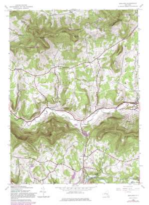
Ashland Topo Map New York
To zoom in, hover over the map of Ashland
USGS Topo Quad 42074c3 - 1:24,000 scale
| Topo Map Name: | Ashland |
| USGS Topo Quad ID: | 42074c3 |
| Print Size: | ca. 21 1/4" wide x 27" high |
| Southeast Coordinates: | 42.25° N latitude / 74.25° W longitude |
| Map Center Coordinates: | 42.3125° N latitude / 74.3125° W longitude |
| U.S. State: | NY |
| Filename: | o42074c3.jpg |
| Download Map JPG Image: | Ashland topo map 1:24,000 scale |
| Map Type: | Topographic |
| Topo Series: | 7.5´ |
| Map Scale: | 1:24,000 |
| Source of Map Images: | United States Geological Survey (USGS) |
| Alternate Map Versions: |
Ashland NY 1945, updated 1963 Download PDF Buy paper map Ashland NY 1945, updated 1969 Download PDF Buy paper map Ashland NY 1945, updated 1980 Download PDF Buy paper map Ashland NY 1946 Download PDF Buy paper map Ashland NY 2010 Download PDF Buy paper map Ashland NY 2013 Download PDF Buy paper map Ashland NY 2016 Download PDF Buy paper map |
1:24,000 Topo Quads surrounding Ashland
> Back to 42074a1 at 1:100,000 scale
> Back to 42074a1 at 1:250,000 scale
> Back to U.S. Topo Maps home
Ashland topo map: Gazetteer
Ashland: Pillars
Ashland Pinnacle elevation 926m 3038′Ashland: Populated Places
Ashland elevation 433m 1420′Jewett elevation 549m 1801′
North Settlement elevation 566m 1856′
West Jewett elevation 578m 1896′
West Settlement elevation 630m 2066′
Windham elevation 462m 1515′
Ashland: Streams
Lewis Creek elevation 412m 1351′Roaring Brook elevation 449m 1473′
Ashland: Summits
Bump Mountain elevation 750m 2460′Huntersfield Mountain elevation 1043m 3421′
Richmond Mountain elevation 980m 3215′
South Mountain elevation 880m 2887′
The Knob elevation 804m 2637′
Tower Mountain elevation 904m 2965′
Ashland: Valleys
Sutton Hollow elevation 433m 1420′Ashland digital topo map on disk
Buy this Ashland topo map showing relief, roads, GPS coordinates and other geographical features, as a high-resolution digital map file on DVD:
New York, Vermont, Connecticut & Western Massachusetts
Buy digital topo maps: New York, Vermont, Connecticut & Western Massachusetts


