Hobart Topo Map New York
To zoom in, hover over the map of Hobart
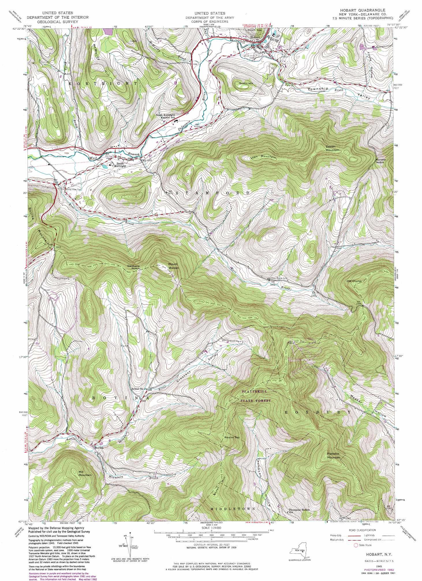
USGS Topo Quad 42074c6 - 1:24,000 scale
| Topo Map Name: | Hobart |
| USGS Topo Quad ID: | 42074c6 |
| Print Size: | ca. 21 1/4" wide x 27" high |
| Southeast Coordinates: | 42.25° N latitude / 74.625° W longitude |
| Map Center Coordinates: | 42.3125° N latitude / 74.6875° W longitude |
| U.S. State: | NY |
| Filename: | o42074c6.jpg |
| Download Map JPG Image: | Hobart topo map 1:24,000 scale |
| Map Type: | Topographic |
| Topo Series: | 7.5´ |
| Map Scale: | 1:24,000 |
| Source of Map Images: | United States Geological Survey (USGS) |
| Alternate Map Versions: |
Hobart NY 1945, updated 1960 Download PDF Buy paper map Hobart NY 1945, updated 1969 Download PDF Buy paper map Hobart NY 1945, updated 1982 Download PDF Buy paper map Hobart NY 2010 Download PDF Buy paper map Hobart NY 2013 Download PDF Buy paper map Hobart NY 2016 Download PDF Buy paper map |
1:24,000 Topo Quads surrounding Hobart
Milford |
Schenevus |
Charlotteville |
Summit |
Breakabeen |
West Davenport |
Davenport |
Harpersfield |
Stamford |
Gilboa |
Delhi |
Bloomville |
Hobart |
Roxbury |
Prattsville |
Hamden |
Andes |
Margaretville |
Fleischmanns |
West Kill |
Downsville |
Lewbeach |
Arena |
Seager |
Shandaken |
> Back to 42074a1 at 1:100,000 scale
> Back to 42074a1 at 1:250,000 scale
> Back to U.S. Topo Maps home
Hobart topo map: Gazetteer
Hobart: Airports
Graces 4000 Airport elevation 454m 1489′Hobart: Gaps
Carmans Notch elevation 773m 2536′Narrow Notch elevation 756m 2480′
Hobart: Populated Places
Bovina elevation 562m 1843′Hobart elevation 503m 1650′
South Kortright elevation 460m 1509′
Hobart: Streams
Betty Brook elevation 452m 1482′Lake Brook elevation 483m 1584′
McMurdy Brook elevation 482m 1581′
Mountain Brook elevation 552m 1811′
Town Brook elevation 483m 1584′
Hobart: Summits
Bovina Mountain elevation 775m 2542′Burnt Hill elevation 884m 2900′
Cowan Mountain elevation 935m 3067′
Griffin Hill elevation 611m 2004′
Lyon Mountain elevation 892m 2926′
McMurdy Hill elevation 691m 2267′
Mill Mountain elevation 800m 2624′
Mount Warren elevation 881m 2890′
Old Clump elevation 891m 2923′
Plattekill Mountain elevation 996m 3267′
Round Top elevation 935m 3067′
Hobart: Valleys
Crescent Hollow elevation 553m 1814′Foote Hollow elevation 536m 1758′
Township Valley elevation 490m 1607′
Hobart digital topo map on disk
Buy this Hobart topo map showing relief, roads, GPS coordinates and other geographical features, as a high-resolution digital map file on DVD:
New York, Vermont, Connecticut & Western Massachusetts
Buy digital topo maps: New York, Vermont, Connecticut & Western Massachusetts