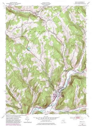
Delhi Topo Map New York
To zoom in, hover over the map of Delhi
USGS Topo Quad 42074c8 - 1:24,000 scale
| Topo Map Name: | Delhi |
| USGS Topo Quad ID: | 42074c8 |
| Print Size: | ca. 21 1/4" wide x 27" high |
| Southeast Coordinates: | 42.25° N latitude / 74.875° W longitude |
| Map Center Coordinates: | 42.3125° N latitude / 74.9375° W longitude |
| U.S. State: | NY |
| Filename: | o42074c8.jpg |
| Download Map JPG Image: | Delhi topo map 1:24,000 scale |
| Map Type: | Topographic |
| Topo Series: | 7.5´ |
| Map Scale: | 1:24,000 |
| Source of Map Images: | United States Geological Survey (USGS) |
| Alternate Map Versions: |
Delhi NY 1943, updated 1953 Download PDF Buy paper map Delhi NY 1943, updated 1970 Download PDF Buy paper map Delhi NY 1943, updated 1983 Download PDF Buy paper map Delhi NY 2010 Download PDF Buy paper map Delhi NY 2013 Download PDF Buy paper map Delhi NY 2016 Download PDF Buy paper map |
1:24,000 Topo Quads surrounding Delhi
> Back to 42074a1 at 1:100,000 scale
> Back to 42074a1 at 1:250,000 scale
> Back to U.S. Topo Maps home
Delhi topo map: Gazetteer
Delhi: Bridges
Fitches Covered Bridge elevation 415m 1361′Delhi: Falls
Watauga Falls elevation 459m 1505′Delhi: Lakes
Spring Lake elevation 625m 2050′Delhi: Parks
Delhi Community Park elevation 416m 1364′Delhi: Populated Places
Delhi elevation 418m 1371′East Delhi elevation 422m 1384′
Meredith elevation 661m 2168′
Meridale elevation 542m 1778′
Delhi: Reservoirs
Delhi Reservoir elevation 470m 1541′Delhi: Ridges
Rattail Ridge elevation 662m 2171′Delhi: Streams
East Platner Brook elevation 433m 1420′Elk Creek elevation 415m 1361′
Falls Creek elevation 415m 1361′
Honest Brook elevation 500m 1640′
Hughes Brook elevation 433m 1420′
Little Delaware River elevation 404m 1325′
Peaks Brook elevation 396m 1299′
Steele Brook elevation 408m 1338′
Toll Gate Brook elevation 430m 1410′
West Platner Brook elevation 433m 1420′
Delhi: Summits
Big Tom elevation 715m 2345′Federal Hill elevation 685m 2247′
Hollister Hill elevation 631m 2070′
Mount Meredith elevation 715m 2345′
Delhi digital topo map on disk
Buy this Delhi topo map showing relief, roads, GPS coordinates and other geographical features, as a high-resolution digital map file on DVD:
New York, Vermont, Connecticut & Western Massachusetts
Buy digital topo maps: New York, Vermont, Connecticut & Western Massachusetts


