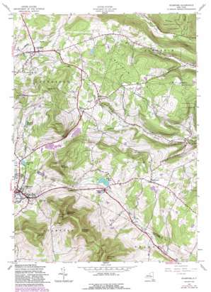
Stamford Topo Map New York
To zoom in, hover over the map of Stamford
USGS Topo Quad 42074d5 - 1:24,000 scale
| Topo Map Name: | Stamford |
| USGS Topo Quad ID: | 42074d5 |
| Print Size: | ca. 21 1/4" wide x 27" high |
| Southeast Coordinates: | 42.375° N latitude / 74.5° W longitude |
| Map Center Coordinates: | 42.4375° N latitude / 74.5625° W longitude |
| U.S. State: | NY |
| Filename: | o42074d5.jpg |
| Download Map JPG Image: | Stamford topo map 1:24,000 scale |
| Map Type: | Topographic |
| Topo Series: | 7.5´ |
| Map Scale: | 1:24,000 |
| Source of Map Images: | United States Geological Survey (USGS) |
| Alternate Map Versions: |
Stamford NY 1945, updated 1960 Download PDF Buy paper map Stamford NY 1945, updated 1969 Download PDF Buy paper map Stamford NY 1945, updated 1982 Download PDF Buy paper map Stamford NY 1945, updated 1988 Download PDF Buy paper map Stamford NY 2010 Download PDF Buy paper map Stamford NY 2013 Download PDF Buy paper map Stamford NY 2016 Download PDF Buy paper map |
1:24,000 Topo Quads surrounding Stamford
> Back to 42074a1 at 1:100,000 scale
> Back to 42074a1 at 1:250,000 scale
> Back to U.S. Topo Maps home
Stamford topo map: Gazetteer
Stamford: Populated Places
Jefferson elevation 569m 1866′South Gilboa elevation 610m 2001′
South Gilboa Station elevation 544m 1784′
South Jefferson elevation 580m 1902′
Stamford elevation 554m 1817′
Stamford: Reservoirs
Mayham Pond elevation 530m 1738′Stamford Reservoir elevation 629m 2063′
Utsayantha Lake elevation 571m 1873′
Stamford: Streams
Betty Brook elevation 362m 1187′Stamford: Summits
Bald Mountain elevation 830m 2723′Blenheim Hill elevation 629m 2063′
Churchill Mountain elevation 934m 3064′
McGregor Mountain elevation 973m 3192′
Mine Hill elevation 858m 2814′
Moore Hill elevation 714m 2342′
Mount Jefferson elevation 833m 2732′
Utsayantha Mountain elevation 978m 3208′
Woodchuck Hill elevation 817m 2680′
Stamford: Valleys
Cornell Hollow elevation 489m 1604′Whiting Hollow elevation 468m 1535′
Stamford digital topo map on disk
Buy this Stamford topo map showing relief, roads, GPS coordinates and other geographical features, as a high-resolution digital map file on DVD:
New York, Vermont, Connecticut & Western Massachusetts
Buy digital topo maps: New York, Vermont, Connecticut & Western Massachusetts


