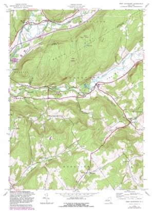
West Davenport Topo Map New York
To zoom in, hover over the map of West Davenport
USGS Topo Quad 42074d8 - 1:24,000 scale
| Topo Map Name: | West Davenport |
| USGS Topo Quad ID: | 42074d8 |
| Print Size: | ca. 21 1/4" wide x 27" high |
| Southeast Coordinates: | 42.375° N latitude / 74.875° W longitude |
| Map Center Coordinates: | 42.4375° N latitude / 74.9375° W longitude |
| U.S. State: | NY |
| Filename: | o42074d8.jpg |
| Download Map JPG Image: | West Davenport topo map 1:24,000 scale |
| Map Type: | Topographic |
| Topo Series: | 7.5´ |
| Map Scale: | 1:24,000 |
| Source of Map Images: | United States Geological Survey (USGS) |
| Alternate Map Versions: |
West Davenport NY 1943, updated 1960 Download PDF Buy paper map West Davenport NY 1943, updated 1970 Download PDF Buy paper map West Davenport NY 1943, updated 1983 Download PDF Buy paper map West Davenport NY 2010 Download PDF Buy paper map West Davenport NY 2013 Download PDF Buy paper map West Davenport NY 2016 Download PDF Buy paper map |
1:24,000 Topo Quads surrounding West Davenport
> Back to 42074a1 at 1:100,000 scale
> Back to 42074a1 at 1:250,000 scale
> Back to U.S. Topo Maps home
West Davenport topo map: Gazetteer
West Davenport: Airports
Tomahawk Hills Airport elevation 722m 2368′West Davenport: Lakes
Mud Lake elevation 542m 1778′Pine Lake elevation 370m 1213′
West Davenport: Populated Places
Colliersville elevation 344m 1128′Cooperstown Junction elevation 356m 1167′
Davenport Center elevation 371m 1217′
East Meredith elevation 427m 1400′
Pindars Corners elevation 395m 1295′
Shackport elevation 611m 2004′
West Davenport elevation 360m 1181′
West Davenport: Streams
Crawford Brook elevation 366m 1200′Dona Brook elevation 372m 1220′
Kortright Creek elevation 366m 1200′
Mine Brook elevation 413m 1354′
Schenevus Creek elevation 336m 1102′
West Davenport: Summits
Dutch Hill elevation 526m 1725′Webb Hill elevation 593m 1945′
West Davenport: Valleys
Houghtaling Hollow elevation 479m 1571′Prosser Hollow elevation 345m 1131′
Pumpkin Hollow elevation 374m 1227′
West Davenport digital topo map on disk
Buy this West Davenport topo map showing relief, roads, GPS coordinates and other geographical features, as a high-resolution digital map file on DVD:
New York, Vermont, Connecticut & Western Massachusetts
Buy digital topo maps: New York, Vermont, Connecticut & Western Massachusetts


