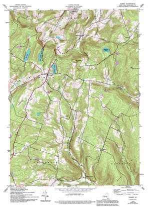
Summit Topo Map New York
To zoom in, hover over the map of Summit
USGS Topo Quad 42074e5 - 1:24,000 scale
| Topo Map Name: | Summit |
| USGS Topo Quad ID: | 42074e5 |
| Print Size: | ca. 21 1/4" wide x 27" high |
| Southeast Coordinates: | 42.5° N latitude / 74.5° W longitude |
| Map Center Coordinates: | 42.5625° N latitude / 74.5625° W longitude |
| U.S. State: | NY |
| Filename: | o42074e5.jpg |
| Download Map JPG Image: | Summit topo map 1:24,000 scale |
| Map Type: | Topographic |
| Topo Series: | 7.5´ |
| Map Scale: | 1:24,000 |
| Source of Map Images: | United States Geological Survey (USGS) |
| Alternate Map Versions: |
Summit NY 1943, updated 1960 Download PDF Buy paper map Summit NY 1943, updated 1971 Download PDF Buy paper map Summit NY 1943, updated 1990 Download PDF Buy paper map Summit NY 1943, updated 1994 Download PDF Buy paper map Summit NY 2010 Download PDF Buy paper map Summit NY 2013 Download PDF Buy paper map Summit NY 2016 Download PDF Buy paper map |
1:24,000 Topo Quads surrounding Summit
> Back to 42074e1 at 1:100,000 scale
> Back to 42074a1 at 1:250,000 scale
> Back to U.S. Topo Maps home
Summit topo map: Gazetteer
Summit: Lakes
Baldwin Pond elevation 619m 2030′Fly Pond elevation 637m 2089′
Mud Lake elevation 697m 2286′
Rossman Pond elevation 626m 2053′
Summit Lake elevation 630m 2066′
Summit: Populated Places
Beards Hollow elevation 424m 1391′East Jefferson elevation 490m 1607′
Eminence elevation 619m 2030′
Summit elevation 645m 2116′
Vorman Corners elevation 413m 1354′
Summit: Reservoirs
Bear Gulch Pond elevation 641m 2103′Summit: Streams
Wharton Hollow Creek elevation 409m 1341′Summit: Summits
The Cobble elevation 710m 2329′Summit: Valleys
Sawyer Hollow elevation 511m 1676′Wharton Hollow elevation 413m 1354′
Summit digital topo map on disk
Buy this Summit topo map showing relief, roads, GPS coordinates and other geographical features, as a high-resolution digital map file on DVD:
New York, Vermont, Connecticut & Western Massachusetts
Buy digital topo maps: New York, Vermont, Connecticut & Western Massachusetts


