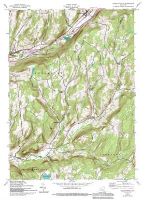
Charlotteville Topo Map New York
To zoom in, hover over the map of Charlotteville
USGS Topo Quad 42074e6 - 1:24,000 scale
| Topo Map Name: | Charlotteville |
| USGS Topo Quad ID: | 42074e6 |
| Print Size: | ca. 21 1/4" wide x 27" high |
| Southeast Coordinates: | 42.5° N latitude / 74.625° W longitude |
| Map Center Coordinates: | 42.5625° N latitude / 74.6875° W longitude |
| U.S. State: | NY |
| Filename: | o42074e6.jpg |
| Download Map JPG Image: | Charlotteville topo map 1:24,000 scale |
| Map Type: | Topographic |
| Topo Series: | 7.5´ |
| Map Scale: | 1:24,000 |
| Source of Map Images: | United States Geological Survey (USGS) |
| Alternate Map Versions: |
Charlotteville NY 1943, updated 1960 Download PDF Buy paper map Charlotteville NY 1943, updated 1972 Download PDF Buy paper map Charlotteville NY 1943, updated 1983 Download PDF Buy paper map Charlotteville NY 1943, updated 1994 Download PDF Buy paper map Charlotteville NY 2010 Download PDF Buy paper map Charlotteville NY 2013 Download PDF Buy paper map Charlotteville NY 2016 Download PDF Buy paper map |
1:24,000 Topo Quads surrounding Charlotteville
> Back to 42074e1 at 1:100,000 scale
> Back to 42074a1 at 1:250,000 scale
> Back to U.S. Topo Maps home
Charlotteville topo map: Gazetteer
Charlotteville: Lakes
Hudson Lake elevation 427m 1400′Titus Lake elevation 621m 2037′
Charlotteville: Populated Places
Arabia elevation 621m 2037′Charlotteville elevation 489m 1604′
East Worcester elevation 446m 1463′
Lutheranville elevation 581m 1906′
South Worcester elevation 419m 1374′
Charlotteville: Streams
Clapper Hollow Creek elevation 439m 1440′Oak Creek elevation 430m 1410′
Charlotteville: Summits
Meade Hill elevation 619m 2030′Pine Hill elevation 629m 2063′
Strain Mountain elevation 609m 1998′
Wayman Hill elevation 627m 2057′
Charlotteville: Valleys
Center Valley elevation 437m 1433′Clapper Hollow elevation 450m 1476′
Charlotteville digital topo map on disk
Buy this Charlotteville topo map showing relief, roads, GPS coordinates and other geographical features, as a high-resolution digital map file on DVD:
New York, Vermont, Connecticut & Western Massachusetts
Buy digital topo maps: New York, Vermont, Connecticut & Western Massachusetts


