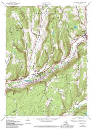
Schenevus Topo Map New York
To zoom in, hover over the map of Schenevus
USGS Topo Quad 42074e7 - 1:24,000 scale
| Topo Map Name: | Schenevus |
| USGS Topo Quad ID: | 42074e7 |
| Print Size: | ca. 21 1/4" wide x 27" high |
| Southeast Coordinates: | 42.5° N latitude / 74.75° W longitude |
| Map Center Coordinates: | 42.5625° N latitude / 74.8125° W longitude |
| U.S. State: | NY |
| Filename: | o42074e7.jpg |
| Download Map JPG Image: | Schenevus topo map 1:24,000 scale |
| Map Type: | Topographic |
| Topo Series: | 7.5´ |
| Map Scale: | 1:24,000 |
| Source of Map Images: | United States Geological Survey (USGS) |
| Alternate Map Versions: |
Schenevus NY 1943, updated 1960 Download PDF Buy paper map Schenevus NY 1943, updated 1971 Download PDF Buy paper map Schenevus NY 1943, updated 1983 Download PDF Buy paper map Schenevus NY 1943, updated 1994 Download PDF Buy paper map Schenevus NY 2010 Download PDF Buy paper map Schenevus NY 2013 Download PDF Buy paper map Schenevus NY 2016 Download PDF Buy paper map |
1:24,000 Topo Quads surrounding Schenevus
> Back to 42074e1 at 1:100,000 scale
> Back to 42074a1 at 1:250,000 scale
> Back to U.S. Topo Maps home
Schenevus topo map: Gazetteer
Schenevus: Lakes
Caryl Lake elevation 552m 1811′Clapper Lake elevation 603m 1978′
Seward Lake elevation 378m 1240′
Schenevus: Populated Places
Chaseville elevation 387m 1269′Elk Creek elevation 404m 1325′
Schenevus elevation 397m 1302′
Simpsonville elevation 420m 1377′
Tuscan elevation 403m 1322′
Worcester elevation 407m 1335′
Schenevus: Streams
Decatur Creek elevation 395m 1295′Elk Creek elevation 366m 1200′
Little Elk Creek elevation 409m 1341′
Palmer Creek elevation 379m 1243′
Sparrowhawk Brook elevation 376m 1233′
Schenevus: Summits
Badeau Hill elevation 584m 1916′Dog Hill elevation 678m 2224′
Hooker Mountain elevation 709m 2326′
South Hill elevation 680m 2230′
Schenevus: Valleys
Smoky Hollow elevation 377m 1236′Sperry Hollow elevation 389m 1276′
Schenevus digital topo map on disk
Buy this Schenevus topo map showing relief, roads, GPS coordinates and other geographical features, as a high-resolution digital map file on DVD:
New York, Vermont, Connecticut & Western Massachusetts
Buy digital topo maps: New York, Vermont, Connecticut & Western Massachusetts


