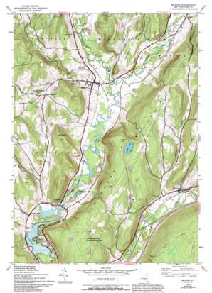
Milford Topo Map New York
To zoom in, hover over the map of Milford
USGS Topo Quad 42074e8 - 1:24,000 scale
| Topo Map Name: | Milford |
| USGS Topo Quad ID: | 42074e8 |
| Print Size: | ca. 21 1/4" wide x 27" high |
| Southeast Coordinates: | 42.5° N latitude / 74.875° W longitude |
| Map Center Coordinates: | 42.5625° N latitude / 74.9375° W longitude |
| U.S. State: | NY |
| Filename: | o42074e8.jpg |
| Download Map JPG Image: | Milford topo map 1:24,000 scale |
| Map Type: | Topographic |
| Topo Series: | 7.5´ |
| Map Scale: | 1:24,000 |
| Source of Map Images: | United States Geological Survey (USGS) |
| Alternate Map Versions: |
Milford NY 1943, updated 1953 Download PDF Buy paper map Milford NY 1943, updated 1968 Download PDF Buy paper map Milford NY 1943, updated 1983 Download PDF Buy paper map Milford NY 1943, updated 1994 Download PDF Buy paper map Milford NY 2010 Download PDF Buy paper map Milford NY 2013 Download PDF Buy paper map Milford NY 2016 Download PDF Buy paper map |
1:24,000 Topo Quads surrounding Milford
> Back to 42074e1 at 1:100,000 scale
> Back to 42074a1 at 1:250,000 scale
> Back to U.S. Topo Maps home
Milford topo map: Gazetteer
Milford: Lakes
Crumhorn Lake elevation 558m 1830′Goodyear Lake elevation 347m 1138′
Saddlebag Lake elevation 357m 1171′
Milford: Populated Places
Cliffside elevation 361m 1184′Clintonville elevation 393m 1289′
Maryland elevation 375m 1230′
Milford elevation 368m 1207′
Milford Center elevation 364m 1194′
Portlandville elevation 351m 1151′
Milford: Streams
Cherry Valley Creek elevation 347m 1138′Morehouse Brook elevation 355m 1164′
Potato Creek elevation 348m 1141′
Whitney Brook elevation 359m 1177′
Milford: Summits
Burying Ground Hill elevation 520m 1706′Crumhorn Mountain elevation 586m 1922′
Dutch Hill elevation 518m 1699′
Eggleston Hill elevation 537m 1761′
Red Ridge Hill elevation 537m 1761′
Milford: Valleys
Cherry Valley elevation 360m 1181′Hinman Hollow elevation 358m 1174′
Platt Hollow elevation 368m 1207′
Milford digital topo map on disk
Buy this Milford topo map showing relief, roads, GPS coordinates and other geographical features, as a high-resolution digital map file on DVD:
New York, Vermont, Connecticut & Western Massachusetts
Buy digital topo maps: New York, Vermont, Connecticut & Western Massachusetts


