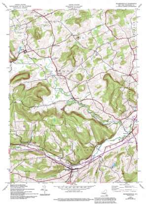
Richmondville Topo Map New York
To zoom in, hover over the map of Richmondville
USGS Topo Quad 42074f5 - 1:24,000 scale
| Topo Map Name: | Richmondville |
| USGS Topo Quad ID: | 42074f5 |
| Print Size: | ca. 21 1/4" wide x 27" high |
| Southeast Coordinates: | 42.625° N latitude / 74.5° W longitude |
| Map Center Coordinates: | 42.6875° N latitude / 74.5625° W longitude |
| U.S. State: | NY |
| Filename: | o42074f5.jpg |
| Download Map JPG Image: | Richmondville topo map 1:24,000 scale |
| Map Type: | Topographic |
| Topo Series: | 7.5´ |
| Map Scale: | 1:24,000 |
| Source of Map Images: | United States Geological Survey (USGS) |
| Alternate Map Versions: |
Richmondville NY 1944, updated 1960 Download PDF Buy paper map Richmondville NY 1944, updated 1973 Download PDF Buy paper map Richmondville NY 1944, updated 1983 Download PDF Buy paper map Richmondville NY 1944, updated 1994 Download PDF Buy paper map Richmondville NY 2010 Download PDF Buy paper map Richmondville NY 2013 Download PDF Buy paper map Richmondville NY 2016 Download PDF Buy paper map |
1:24,000 Topo Quads surrounding Richmondville
> Back to 42074e1 at 1:100,000 scale
> Back to 42074a1 at 1:250,000 scale
> Back to U.S. Topo Maps home
Richmondville topo map: Gazetteer
Richmondville: Lakes
Fuller Pond elevation 515m 1689′Richmondville: Populated Places
Clove elevation 349m 1145′Dorloo elevation 357m 1171′
Gardnersville elevation 372m 1220′
Hyndsville elevation 349m 1145′
Janesville elevation 359m 1177′
Lawyersville elevation 364m 1194′
Richmondville elevation 334m 1095′
Seward elevation 361m 1184′
Warnerville elevation 282m 925′
West Richmondville elevation 415m 1361′
Richmondville: Streams
Schenevus Creek elevation 326m 1069′West Creek elevation 281m 921′
Richmondville: Summits
Pine Hill elevation 525m 1722′Richmondville: Valleys
Bear Gulch elevation 328m 1076′Beards Hollow elevation 304m 997′
Brooker Hollow elevation 334m 1095′
Mickel Hollow elevation 281m 921′
Richmondville digital topo map on disk
Buy this Richmondville topo map showing relief, roads, GPS coordinates and other geographical features, as a high-resolution digital map file on DVD:
New York, Vermont, Connecticut & Western Massachusetts
Buy digital topo maps: New York, Vermont, Connecticut & Western Massachusetts


