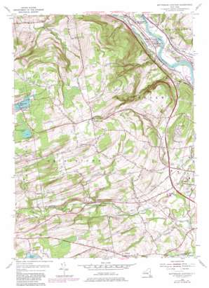
Rotterdam Junction Topo Map New York
To zoom in, hover over the map of Rotterdam Junction
USGS Topo Quad 42074g1 - 1:24,000 scale
| Topo Map Name: | Rotterdam Junction |
| USGS Topo Quad ID: | 42074g1 |
| Print Size: | ca. 21 1/4" wide x 27" high |
| Southeast Coordinates: | 42.75° N latitude / 74° W longitude |
| Map Center Coordinates: | 42.8125° N latitude / 74.0625° W longitude |
| U.S. State: | NY |
| Filename: | o42074g1.jpg |
| Download Map JPG Image: | Rotterdam Junction topo map 1:24,000 scale |
| Map Type: | Topographic |
| Topo Series: | 7.5´ |
| Map Scale: | 1:24,000 |
| Source of Map Images: | United States Geological Survey (USGS) |
| Alternate Map Versions: |
Rotterdam Junction NY 1954, updated 1956 Download PDF Buy paper map Rotterdam Junction NY 1954, updated 1968 Download PDF Buy paper map Rotterdam Junction NY 1954, updated 1980 Download PDF Buy paper map Rotterdam Junction NY 1954, updated 1980 Download PDF Buy paper map Rotterdam Junction NY 2010 Download PDF Buy paper map Rotterdam Junction NY 2013 Download PDF Buy paper map Rotterdam Junction NY 2016 Download PDF Buy paper map |
1:24,000 Topo Quads surrounding Rotterdam Junction
> Back to 42074e1 at 1:100,000 scale
> Back to 42074a1 at 1:250,000 scale
> Back to U.S. Topo Maps home
Rotterdam Junction topo map: Gazetteer
Rotterdam Junction: Airports
Valley Airpark elevation 72m 236′Rotterdam Junction: Lakes
Featherstonhaugh Lake elevation 393m 1289′Mariaville Lake elevation 388m 1272′
Rotterdam Junction: Populated Places
Duane Lake elevation 281m 921′Gifford elevation 191m 626′
Hillcrest Mobile Home Park elevation 251m 823′
Kelleys elevation 153m 501′
Lower Rotterdam Junction elevation 76m 249′
Princetown elevation 128m 419′
Rectors elevation 81m 265′
Rotterdam Junction elevation 76m 249′
Rynex Corners elevation 305m 1000′
West Hill elevation 182m 597′
Wyatts elevation 80m 262′
Rotterdam Junction: Streams
Bonny Brook elevation 125m 410′Moccasin Kill elevation 74m 242′
Plotter Kill elevation 69m 226′
Washout Creek elevation 70m 229′
Rotterdam Junction: Valleys
Rabbit Hollow elevation 73m 239′Rotterdam Junction digital topo map on disk
Buy this Rotterdam Junction topo map showing relief, roads, GPS coordinates and other geographical features, as a high-resolution digital map file on DVD:
New York, Vermont, Connecticut & Western Massachusetts
Buy digital topo maps: New York, Vermont, Connecticut & Western Massachusetts


