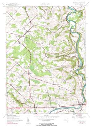
Esperance Topo Map New York
To zoom in, hover over the map of Esperance
USGS Topo Quad 42074g3 - 1:24,000 scale
| Topo Map Name: | Esperance |
| USGS Topo Quad ID: | 42074g3 |
| Print Size: | ca. 21 1/4" wide x 27" high |
| Southeast Coordinates: | 42.75° N latitude / 74.25° W longitude |
| Map Center Coordinates: | 42.8125° N latitude / 74.3125° W longitude |
| U.S. State: | NY |
| Filename: | o42074g3.jpg |
| Download Map JPG Image: | Esperance topo map 1:24,000 scale |
| Map Type: | Topographic |
| Topo Series: | 7.5´ |
| Map Scale: | 1:24,000 |
| Source of Map Images: | United States Geological Survey (USGS) |
| Alternate Map Versions: |
Esperance NY 1943, updated 1959 Download PDF Buy paper map Esperance NY 1943, updated 1984 Download PDF Buy paper map Esperance NY 2010 Download PDF Buy paper map Esperance NY 2013 Download PDF Buy paper map Esperance NY 2016 Download PDF Buy paper map |
1:24,000 Topo Quads surrounding Esperance
> Back to 42074e1 at 1:100,000 scale
> Back to 42074a1 at 1:250,000 scale
> Back to U.S. Topo Maps home
Esperance topo map: Gazetteer
Esperance: Airports
Hogan Airport elevation 380m 1246′Esperance: Lakes
Youngs Lakes elevation 115m 377′Esperance: Populated Places
Burtonsville elevation 157m 515′Charleston elevation 347m 1138′
Dwelly Corners elevation 303m 994′
Esperance elevation 177m 580′
Lost Valley elevation 131m 429′
Oak Ridge elevation 413m 1354′
Sloansville elevation 207m 679′
Esperance: Reservoirs
Conover Pond elevation 370m 1213′Esperance: Streams
Bowman Creek elevation 149m 488′Wilsey Creek elevation 141m 462′
Esperance digital topo map on disk
Buy this Esperance topo map showing relief, roads, GPS coordinates and other geographical features, as a high-resolution digital map file on DVD:
New York, Vermont, Connecticut & Western Massachusetts
Buy digital topo maps: New York, Vermont, Connecticut & Western Massachusetts


