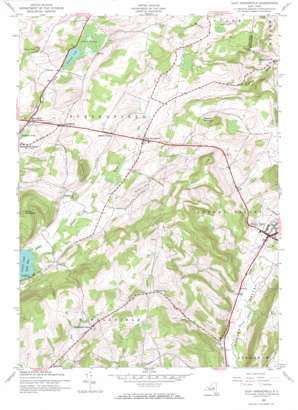
East Springfield Topo Map New York
To zoom in, hover over the map of East Springfield
USGS Topo Quad 42074g7 - 1:24,000 scale
| Topo Map Name: | East Springfield |
| USGS Topo Quad ID: | 42074g7 |
| Print Size: | ca. 21 1/4" wide x 27" high |
| Southeast Coordinates: | 42.75° N latitude / 74.75° W longitude |
| Map Center Coordinates: | 42.8125° N latitude / 74.8125° W longitude |
| U.S. State: | NY |
| Filename: | o42074g7.jpg |
| Download Map JPG Image: | East Springfield topo map 1:24,000 scale |
| Map Type: | Topographic |
| Topo Series: | 7.5´ |
| Map Scale: | 1:24,000 |
| Source of Map Images: | United States Geological Survey (USGS) |
| Alternate Map Versions: |
East Springfield NY 1943, updated 1960 Download PDF Buy paper map East Springfield NY 1943, updated 1971 Download PDF Buy paper map East Springfield NY 2010 Download PDF Buy paper map East Springfield NY 2013 Download PDF Buy paper map East Springfield NY 2016 Download PDF Buy paper map |
1:24,000 Topo Quads surrounding East Springfield
> Back to 42074e1 at 1:100,000 scale
> Back to 42074a1 at 1:250,000 scale
> Back to U.S. Topo Maps home
East Springfield topo map: Gazetteer
East Springfield: Airports
De Ronda Airport elevation 507m 1663′East Springfield: Bays
Hyde Bay elevation 363m 1190′East Springfield: Bridges
Hyde Hall Covered Bridge elevation 365m 1197′East Springfield: Lakes
Shipman Pond elevation 383m 1256′Summit Lake elevation 411m 1348′
East Springfield: Populated Places
Cherry Valley elevation 410m 1345′East Springfield elevation 403m 1322′
Lentsville elevation 465m 1525′
Middle Village elevation 434m 1423′
Middlefield Center elevation 505m 1656′
Springfield elevation 413m 1354′
Springfield Four Corners elevation 392m 1286′
East Springfield: Streams
Shadow Brook elevation 363m 1190′East Springfield: Summits
Briar Hill elevation 490m 1607′Cape Wykoff elevation 604m 1981′
Mount Tom elevation 490m 1607′
Mount Wellington elevation 557m 1827′
Pine Cobble elevation 538m 1765′
Shankley Mountain elevation 598m 1961′
East Springfield: Swamps
Cedar Swamp elevation 413m 1354′East Springfield: Valleys
Dugway Gorge elevation 303m 994′East Springfield digital topo map on disk
Buy this East Springfield topo map showing relief, roads, GPS coordinates and other geographical features, as a high-resolution digital map file on DVD:
New York, Vermont, Connecticut & Western Massachusetts
Buy digital topo maps: New York, Vermont, Connecticut & Western Massachusetts


