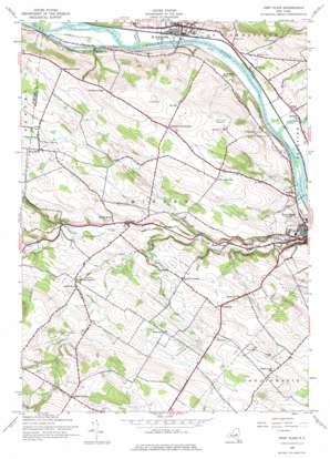
Fort Plain Topo Map New York
To zoom in, hover over the map of Fort Plain
USGS Topo Quad 42074h6 - 1:24,000 scale
| Topo Map Name: | Fort Plain |
| USGS Topo Quad ID: | 42074h6 |
| Print Size: | ca. 21 1/4" wide x 27" high |
| Southeast Coordinates: | 42.875° N latitude / 74.625° W longitude |
| Map Center Coordinates: | 42.9375° N latitude / 74.6875° W longitude |
| U.S. State: | NY |
| Filename: | o42074h6.jpg |
| Download Map JPG Image: | Fort Plain topo map 1:24,000 scale |
| Map Type: | Topographic |
| Topo Series: | 7.5´ |
| Map Scale: | 1:24,000 |
| Source of Map Images: | United States Geological Survey (USGS) |
| Alternate Map Versions: |
Fort Plain NY 1944, updated 1960 Download PDF Buy paper map Fort Plain NY 1944, updated 1975 Download PDF Buy paper map Fort Plain NY 2010 Download PDF Buy paper map Fort Plain NY 2013 Download PDF Buy paper map Fort Plain NY 2016 Download PDF Buy paper map |
1:24,000 Topo Quads surrounding Fort Plain
> Back to 42074e1 at 1:100,000 scale
> Back to 42074a1 at 1:250,000 scale
> Back to U.S. Topo Maps home
Fort Plain topo map: Gazetteer
Fort Plain: Airports
Di Stefano Airpark elevation 163m 534′Hickory Acres Airport elevation 293m 961′
Nellis Field elevation 222m 728′
O'Riley Airport elevation 209m 685′
Fort Plain: Islands
Abeel Island elevation 93m 305′Fort Plain: Populated Places
Brookman Corners elevation 196m 643′Charlesworth Corners elevation 230m 754′
Fordsbush elevation 219m 718′
Freysbush elevation 210m 688′
Hallsville elevation 158m 518′
Keesler Corners elevation 186m 610′
Mindenville elevation 98m 321′
Saint Johnsville elevation 100m 328′
Sand Hill elevation 128m 419′
Valley Brook elevation 123m 403′
West Saint Johnsville elevation 101m 331′
Fort Plain: Streams
Caroga Creek elevation 93m 305′Crum Creek elevation 93m 305′
East Canada Creek elevation 93m 305′
Mother Creek elevation 93m 305′
Timmerman Creek elevation 93m 305′
Zimmerman Creek elevation 93m 305′
Fort Plain digital topo map on disk
Buy this Fort Plain topo map showing relief, roads, GPS coordinates and other geographical features, as a high-resolution digital map file on DVD:
New York, Vermont, Connecticut & Western Massachusetts
Buy digital topo maps: New York, Vermont, Connecticut & Western Massachusetts


