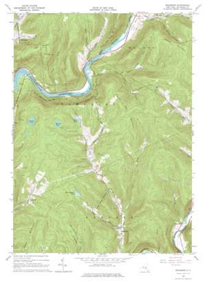
Readburn Topo Map New York
To zoom in, hover over the map of Readburn
USGS Topo Quad 42075a2 - 1:24,000 scale
| Topo Map Name: | Readburn |
| USGS Topo Quad ID: | 42075a2 |
| Print Size: | ca. 21 1/4" wide x 27" high |
| Southeast Coordinates: | 42° N latitude / 75.125° W longitude |
| Map Center Coordinates: | 42.0625° N latitude / 75.1875° W longitude |
| U.S. State: | NY |
| Filename: | o42075a2.jpg |
| Download Map JPG Image: | Readburn topo map 1:24,000 scale |
| Map Type: | Topographic |
| Topo Series: | 7.5´ |
| Map Scale: | 1:24,000 |
| Source of Map Images: | United States Geological Survey (USGS) |
| Alternate Map Versions: |
Readburn NY 1965, updated 1966 Download PDF Buy paper map Readburn NY 1965, updated 1976 Download PDF Buy paper map Readburn NY 1965, updated 1976 Download PDF Buy paper map Readburn NY 2010 Download PDF Buy paper map Readburn NY 2013 Download PDF Buy paper map Readburn NY 2016 Download PDF Buy paper map |
1:24,000 Topo Quads surrounding Readburn
> Back to 42075a1 at 1:100,000 scale
> Back to 42074a1 at 1:250,000 scale
> Back to U.S. Topo Maps home
Readburn topo map: Gazetteer
Readburn: Lakes
Beaver Meadow Pond elevation 525m 1722′Merrick Pond elevation 585m 1919′
Perkins Pond elevation 538m 1765′
Trask Pond elevation 519m 1702′
Readburn: Populated Places
Apex elevation 444m 1456′Centerville elevation 315m 1033′
Kerryville elevation 437m 1433′
Readburn elevation 351m 1151′
Rock Rift elevation 393m 1289′
Readburn: Streams
Chase Brook elevation 350m 1148′Dry Brook elevation 351m 1151′
East Brook elevation 363m 1190′
Fish Brook elevation 351m 1151′
Johnnie Brook elevation 380m 1246′
Morrison Brook elevation 301m 987′
Rich Creek elevation 455m 1492′
Spencer Brook elevation 411m 1348′
Wakeman Brook elevation 361m 1184′
Readburn: Summits
Hawk Mountain elevation 630m 2066′Houck Mountain elevation 748m 2454′
Rock Rift Mountain elevation 730m 2395′
Tower Mountain elevation 707m 2319′
Readburn digital topo map on disk
Buy this Readburn topo map showing relief, roads, GPS coordinates and other geographical features, as a high-resolution digital map file on DVD:
New York, Vermont, Connecticut & Western Massachusetts
Buy digital topo maps: New York, Vermont, Connecticut & Western Massachusetts


