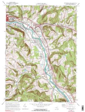
Binghamton East Topo Map New York
To zoom in, hover over the map of Binghamton East
USGS Topo Quad 42075a7 - 1:24,000 scale
| Topo Map Name: | Binghamton East |
| USGS Topo Quad ID: | 42075a7 |
| Print Size: | ca. 21 1/4" wide x 27" high |
| Southeast Coordinates: | 42° N latitude / 75.75° W longitude |
| Map Center Coordinates: | 42.0625° N latitude / 75.8125° W longitude |
| U.S. State: | NY |
| Filename: | o42075a7.jpg |
| Download Map JPG Image: | Binghamton East topo map 1:24,000 scale |
| Map Type: | Topographic |
| Topo Series: | 7.5´ |
| Map Scale: | 1:24,000 |
| Source of Map Images: | United States Geological Survey (USGS) |
| Alternate Map Versions: |
Binghamton East NY 1937 Download PDF Buy paper map Binghamton East NY 1937 Download PDF Buy paper map Binghamton East NY 1961, updated 1964 Download PDF Buy paper map Binghamton East NY 1968, updated 1972 Download PDF Buy paper map Binghamton East NY 1968, updated 1976 Download PDF Buy paper map Binghamton East NY 2010 Download PDF Buy paper map Binghamton East NY 2013 Download PDF Buy paper map Binghamton East NY 2016 Download PDF Buy paper map |
1:24,000 Topo Quads surrounding Binghamton East
> Back to 42075a1 at 1:100,000 scale
> Back to 42074a1 at 1:250,000 scale
> Back to U.S. Topo Maps home
Binghamton East topo map: Gazetteer
Binghamton East: Airports
Kirkwood Airpark elevation 265m 869′Binghamton East: Crossings
Interchange 1 elevation 283m 928′Interchange 2 elevation 269m 882′
Binghamton East: Islands
Berkalew Island elevation 256m 839′Collier Island elevation 255m 836′
Conklin Island elevation 261m 856′
Moore Island elevation 259m 849′
Binghamton East: Lakes
Tripps Pond elevation 389m 1276′Binghamton East: Populated Places
Conklin elevation 265m 869′Conklin Center elevation 262m 859′
Conklin Forks elevation 320m 1049′
Conklin Station elevation 268m 879′
Corbettsville elevation 269m 882′
Fivemile Point elevation 262m 859′
Fountain Blue Mobile Home Park elevation 282m 925′
Kirkwood elevation 272m 892′
Kirkwood Center elevation 288m 944′
Kirkwood Mobile Home Court elevation 282m 925′
Langdon elevation 292m 958′
Pine Manor elevation 258m 846′
Popes Ravine elevation 346m 1135′
Riverside elevation 266m 872′
West Windsor elevation 401m 1315′
Binghamton East: Streams
Acre Creek elevation 253m 830′Carlin Creek elevation 253m 830′
Gratsinger Run elevation 299m 980′
Horton Creek elevation 311m 1020′
Little Snake Creek elevation 256m 839′
Park Creek elevation 254m 833′
Pierce Creek elevation 332m 1089′
Snake Creek elevation 256m 839′
Snake Creek elevation 256m 839′
Stanley Hollow Creek elevation 266m 872′
Stratton Mill Creek elevation 253m 830′
West Fork Little Snake Creek elevation 316m 1036′
Binghamton East: Valleys
Doubleday Glen elevation 273m 895′Sherwood Hollow elevation 278m 912′
Binghamton East digital topo map on disk
Buy this Binghamton East topo map showing relief, roads, GPS coordinates and other geographical features, as a high-resolution digital map file on DVD:
New York, Vermont, Connecticut & Western Massachusetts
Buy digital topo maps: New York, Vermont, Connecticut & Western Massachusetts


