North Sanford Topo Map New York
To zoom in, hover over the map of North Sanford
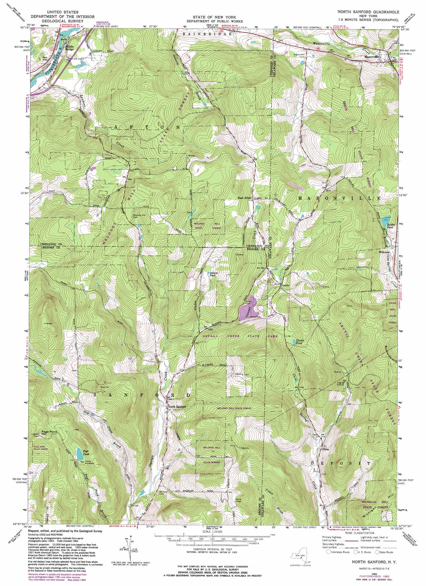
USGS Topo Quad 42075b4 - 1:24,000 scale
| Topo Map Name: | North Sanford |
| USGS Topo Quad ID: | 42075b4 |
| Print Size: | ca. 21 1/4" wide x 27" high |
| Southeast Coordinates: | 42.125° N latitude / 75.375° W longitude |
| Map Center Coordinates: | 42.1875° N latitude / 75.4375° W longitude |
| U.S. State: | NY |
| Filename: | o42075b4.jpg |
| Download Map JPG Image: | North Sanford topo map 1:24,000 scale |
| Map Type: | Topographic |
| Topo Series: | 7.5´ |
| Map Scale: | 1:24,000 |
| Source of Map Images: | United States Geological Survey (USGS) |
| Alternate Map Versions: |
North Sanford NY 1965, updated 1967 Download PDF Buy paper map North Sanford NY 1965, updated 1983 Download PDF Buy paper map North Sanford NY 2010 Download PDF Buy paper map North Sanford NY 2013 Download PDF Buy paper map North Sanford NY 2016 Download PDF Buy paper map |
1:24,000 Topo Quads surrounding North Sanford
Tyner |
Oxford |
Guilford |
Gilbertsville |
Otego |
Brisben |
West Bainbridge |
Sidney |
Unadilla |
Franklin |
Belden |
Afton |
North Sanford |
Trout Creek |
Walton West |
Windsor |
Gulf Summit |
Deposit |
Cannonsville Reservoir |
Readburn |
Great Bend |
Susquehanna |
Starrucca |
Hancock |
Fishs Eddy |
> Back to 42075a1 at 1:100,000 scale
> Back to 42074a1 at 1:250,000 scale
> Back to U.S. Topo Maps home
North Sanford topo map: Gazetteer
North Sanford: Forests
Broome State Forest elevation 505m 1656′Chenango State Forest elevation 508m 1666′
North Sanford: Islands
Balls Island elevation 296m 971′North Sanford: Lakes
Beales Pond elevation 500m 1640′Clarks Pond elevation 547m 1794′
Page Pond elevation 521m 1709′
Stilson Pond elevation 527m 1729′
North Sanford: Populated Places
Arctic elevation 494m 1620′China elevation 412m 1351′
East Afton elevation 541m 1774′
Masonville elevation 394m 1292′
Middle Bridge elevation 301m 987′
North Sanford elevation 417m 1368′
Whitman elevation 492m 1614′
North Sanford: Streams
Dry Brook elevation 382m 1253′Landers Creek elevation 288m 944′
North Sanford: Summits
Burnside Hill elevation 623m 2043′Michigan Hill elevation 621m 2037′
Page Pond Hill elevation 612m 2007′
North Sanford digital topo map on disk
Buy this North Sanford topo map showing relief, roads, GPS coordinates and other geographical features, as a high-resolution digital map file on DVD:
New York, Vermont, Connecticut & Western Massachusetts
Buy digital topo maps: New York, Vermont, Connecticut & Western Massachusetts