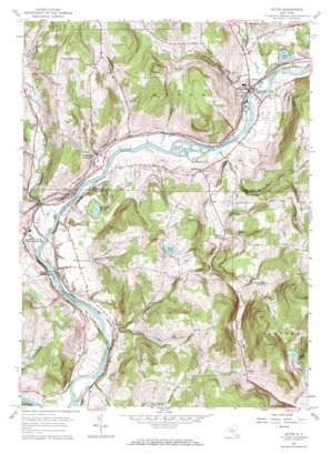
Afton Topo Map New York
To zoom in, hover over the map of Afton
USGS Topo Quad 42075b5 - 1:24,000 scale
| Topo Map Name: | Afton |
| USGS Topo Quad ID: | 42075b5 |
| Print Size: | ca. 21 1/4" wide x 27" high |
| Southeast Coordinates: | 42.125° N latitude / 75.5° W longitude |
| Map Center Coordinates: | 42.1875° N latitude / 75.5625° W longitude |
| U.S. State: | NY |
| Filename: | o42075b5.jpg |
| Download Map JPG Image: | Afton topo map 1:24,000 scale |
| Map Type: | Topographic |
| Topo Series: | 7.5´ |
| Map Scale: | 1:24,000 |
| Source of Map Images: | United States Geological Survey (USGS) |
| Alternate Map Versions: |
Afton NY 1957, updated 1959 Download PDF Buy paper map Afton NY 1957, updated 1971 Download PDF Buy paper map Afton NY 1957, updated 1984 Download PDF Buy paper map Afton NY 1957, updated 1984 Download PDF Buy paper map Afton NY 2010 Download PDF Buy paper map Afton NY 2013 Download PDF Buy paper map Afton NY 2016 Download PDF Buy paper map |
1:24,000 Topo Quads surrounding Afton
> Back to 42075a1 at 1:100,000 scale
> Back to 42074a1 at 1:250,000 scale
> Back to U.S. Topo Maps home
Afton topo map: Gazetteer
Afton: Lakes
Afton Lake elevation 300m 984′Beaver Pond elevation 472m 1548′
Perch Pond elevation 450m 1476′
Pickerel Pond elevation 314m 1030′
Taft Pond elevation 329m 1079′
Afton: Populated Places
Afton elevation 305m 1000′Bettsburg elevation 316m 1036′
Center Village elevation 294m 964′
Doraville elevation 295m 967′
Harpursville elevation 312m 1023′
Howes elevation 456m 1496′
Nineveh elevation 294m 964′
Nineveh Junction elevation 314m 1030′
Vallonia Springs elevation 350m 1148′
Afton: Streams
Belden Brook elevation 287m 941′Bumps Creek elevation 290m 951′
Cornell Creek elevation 286m 938′
Kelsey Creek elevation 291m 954′
Reed Creek elevation 290m 951′
Wylie Brook elevation 287m 941′
Afton digital topo map on disk
Buy this Afton topo map showing relief, roads, GPS coordinates and other geographical features, as a high-resolution digital map file on DVD:
New York, Vermont, Connecticut & Western Massachusetts
Buy digital topo maps: New York, Vermont, Connecticut & Western Massachusetts


