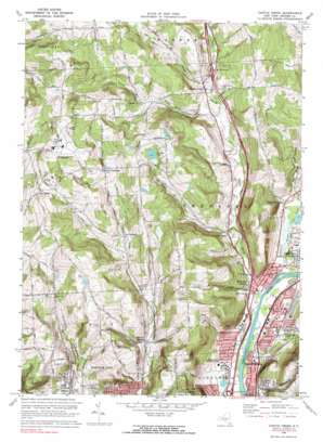
Castle Creek Topo Map New York
To zoom in, hover over the map of Castle Creek
USGS Topo Quad 42075b8 - 1:24,000 scale
| Topo Map Name: | Castle Creek |
| USGS Topo Quad ID: | 42075b8 |
| Print Size: | ca. 21 1/4" wide x 27" high |
| Southeast Coordinates: | 42.125° N latitude / 75.875° W longitude |
| Map Center Coordinates: | 42.1875° N latitude / 75.9375° W longitude |
| U.S. State: | NY |
| Filename: | o42075b8.jpg |
| Download Map JPG Image: | Castle Creek topo map 1:24,000 scale |
| Map Type: | Topographic |
| Topo Series: | 7.5´ |
| Map Scale: | 1:24,000 |
| Source of Map Images: | United States Geological Survey (USGS) |
| Alternate Map Versions: |
Castle Creek NY 1934 Download PDF Buy paper map Castle Creek NY 1942, updated 1960 Download PDF Buy paper map Castle Creek NY 1961, updated 1963 Download PDF Buy paper map Castle Creek NY 1968, updated 1972 Download PDF Buy paper map Castle Creek NY 1968, updated 1983 Download PDF Buy paper map Castle Creek NY 2010 Download PDF Buy paper map Castle Creek NY 2013 Download PDF Buy paper map Castle Creek NY 2016 Download PDF Buy paper map |
1:24,000 Topo Quads surrounding Castle Creek
> Back to 42075a1 at 1:100,000 scale
> Back to 42074a1 at 1:250,000 scale
> Back to U.S. Topo Maps home
Castle Creek topo map: Gazetteer
Castle Creek: Airports
Binghamton Regional Airport-Edwin A Link Field elevation 487m 1597′Castle Creek: Capes
Greene Point elevation 285m 935′Castle Creek: Crossings
Interchange 5 elevation 254m 833′Interchange 6 elevation 265m 869′
Interchange 7 elevation 322m 1056′
Castle Creek: Lakes
Saint Johns Pond elevation 416m 1364′Castle Creek: Parks
Ely Park elevation 433m 1420′Castle Creek: Populated Places
Castle Creek elevation 320m 1049′Choconut Center elevation 300m 984′
East Maine elevation 456m 1496′
Fortress Estates elevation 321m 1053′
Glen Castle elevation 301m 987′
Hinmans Corners elevation 269m 882′
Lees Mobile Home Park elevation 270m 885′
New Ireland elevation 366m 1200′
Newmans Corner elevation 276m 905′
Port Dickinson elevation 263m 862′
Riverview Mobile Home Community elevation 261m 856′
West Chenango elevation 419m 1374′
Castle Creek: Streams
Brooks Creek elevation 310m 1017′Castle Creek elevation 256m 839′
Glen Castle Creek elevation 281m 921′
Phelps Creek elevation 253m 830′
Potato Creek elevation 317m 1040′
Thomas Creek elevation 257m 843′
Castle Creek: Summits
Deyo Hill elevation 442m 1450′Castle Creek digital topo map on disk
Buy this Castle Creek topo map showing relief, roads, GPS coordinates and other geographical features, as a high-resolution digital map file on DVD:
New York, Vermont, Connecticut & Western Massachusetts
Buy digital topo maps: New York, Vermont, Connecticut & Western Massachusetts


