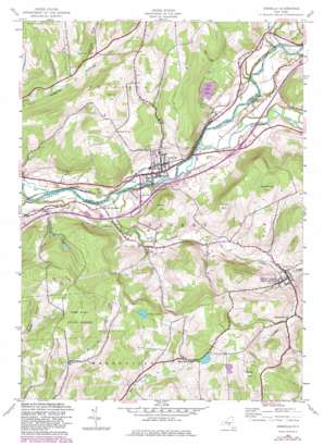
Unadilla Topo Map New York
To zoom in, hover over the map of Unadilla
USGS Topo Quad 42075c3 - 1:24,000 scale
| Topo Map Name: | Unadilla |
| USGS Topo Quad ID: | 42075c3 |
| Print Size: | ca. 21 1/4" wide x 27" high |
| Southeast Coordinates: | 42.25° N latitude / 75.25° W longitude |
| Map Center Coordinates: | 42.3125° N latitude / 75.3125° W longitude |
| U.S. State: | NY |
| Filename: | o42075c3.jpg |
| Download Map JPG Image: | Unadilla topo map 1:24,000 scale |
| Map Type: | Topographic |
| Topo Series: | 7.5´ |
| Map Scale: | 1:24,000 |
| Source of Map Images: | United States Geological Survey (USGS) |
| Alternate Map Versions: |
Unadilla NY 1943, updated 1960 Download PDF Buy paper map Unadilla NY 1943, updated 1972 Download PDF Buy paper map Unadilla NY 1943, updated 1983 Download PDF Buy paper map Unadilla NY 1943, updated 1983 Download PDF Buy paper map Unadilla NY 2010 Download PDF Buy paper map Unadilla NY 2013 Download PDF Buy paper map Unadilla NY 2016 Download PDF Buy paper map |
1:24,000 Topo Quads surrounding Unadilla
> Back to 42075a1 at 1:100,000 scale
> Back to 42074a1 at 1:250,000 scale
> Back to U.S. Topo Maps home
Unadilla topo map: Gazetteer
Unadilla: Lakes
Youngs Pond elevation 558m 1830′Unadilla: Mines
Skytop Quarry elevation 549m 1801′Unadilla: Populated Places
Barnes Trailer Park elevation 344m 1128′East Masonville elevation 504m 1653′
Sidney Center elevation 396m 1299′
South Unadilla elevation 308m 1010′
Unadilla elevation 308m 1010′
Youngs elevation 370m 1213′
Unadilla: Streams
Carrs Creek elevation 299m 980′Ideuma Brook elevation 376m 1233′
Martin Brook elevation 299m 980′
Ouleout Creek elevation 305m 1000′
Sand Hill Creek elevation 309m 1013′
Unadilla: Summits
Couse Hill elevation 641m 2103′Crane Hill elevation 525m 1722′
Kilkenny Hill elevation 538m 1765′
Pine Hill elevation 612m 2007′
Poplar Hill elevation 488m 1601′
Vandervort Hill elevation 586m 1922′
Unadilla: Swamps
The Fly elevation 354m 1161′Unadilla digital topo map on disk
Buy this Unadilla topo map showing relief, roads, GPS coordinates and other geographical features, as a high-resolution digital map file on DVD:
New York, Vermont, Connecticut & Western Massachusetts
Buy digital topo maps: New York, Vermont, Connecticut & Western Massachusetts


