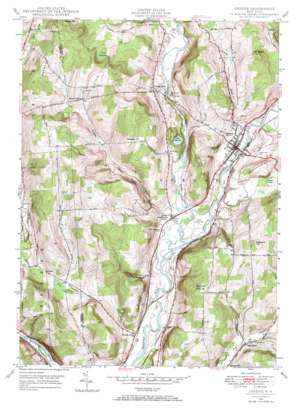
Greene Topo Map New York
To zoom in, hover over the map of Greene
USGS Topo Quad 42075c7 - 1:24,000 scale
| Topo Map Name: | Greene |
| USGS Topo Quad ID: | 42075c7 |
| Print Size: | ca. 21 1/4" wide x 27" high |
| Southeast Coordinates: | 42.25° N latitude / 75.75° W longitude |
| Map Center Coordinates: | 42.3125° N latitude / 75.8125° W longitude |
| U.S. State: | NY |
| Filename: | o42075c7.jpg |
| Download Map JPG Image: | Greene topo map 1:24,000 scale |
| Map Type: | Topographic |
| Topo Series: | 7.5´ |
| Map Scale: | 1:24,000 |
| Source of Map Images: | United States Geological Survey (USGS) |
| Alternate Map Versions: |
Greene NY 1948, updated 1968 Download PDF Buy paper map Greene NY 1950 Download PDF Buy paper map Greene NY 2010 Download PDF Buy paper map Greene NY 2013 Download PDF Buy paper map Greene NY 2016 Download PDF Buy paper map |
1:24,000 Topo Quads surrounding Greene
> Back to 42075a1 at 1:100,000 scale
> Back to 42074a1 at 1:250,000 scale
> Back to U.S. Topo Maps home
Greene topo map: Gazetteer
Greene: Airports
Greene Airport elevation 281m 921′Greene: Lakes
Lake Petonia elevation 291m 954′Greene: Populated Places
Fickles Corner elevation 276m 905′Genegantslet elevation 309m 1013′
Greene elevation 280m 918′
Lower Genegantslet Corner elevation 280m 918′
Page Brook elevation 310m 1017′
Pinewoods Mobile Home Park elevation 290m 951′
Greene: Streams
Birdsall Brook elevation 272m 892′Chalker Creek elevation 306m 1003′
Genegantslet Creek elevation 269m 882′
Indian Brook elevation 274m 898′
Ockerman Brook elevation 268m 879′
Greene: Summits
Bailey Hill elevation 480m 1574′Beaman Hill elevation 434m 1423′
East Juliand Hill elevation 377m 1236′
Juliand Hill elevation 400m 1312′
Mount Arm elevation 464m 1522′
Mount Pisgah elevation 465m 1525′
Pleasant Hill elevation 476m 1561′
Squirrel Hill elevation 457m 1499′
Wagner Hill elevation 455m 1492′
Greene: Swamps
Bear Swamp elevation 322m 1056′Curtis Swamp elevation 309m 1013′
Turk Slashings elevation 410m 1345′
Greene digital topo map on disk
Buy this Greene topo map showing relief, roads, GPS coordinates and other geographical features, as a high-resolution digital map file on DVD:
New York, Vermont, Connecticut & Western Massachusetts
Buy digital topo maps: New York, Vermont, Connecticut & Western Massachusetts


